
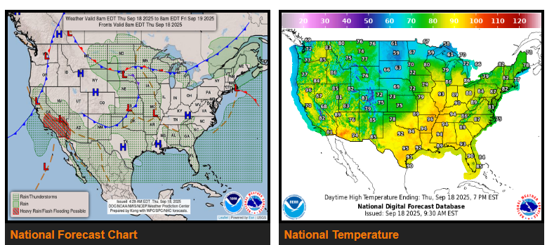
An upper low over the Central U.S. will keep showers and thunderstorms in the forecast through the weekend. Today, the Storm Prediction Center highlights a Marginal Risk for severe weather from Oklahoma to Missouri, with hail and isolated strong wind gusts possible. Scattered storms will continue across the Midwest Friday and Saturday, but most should remain below severe levels. A marginal flash flood threat also exists across the Plains and Midwest, with a few storms capable of producing locally heavy rain.
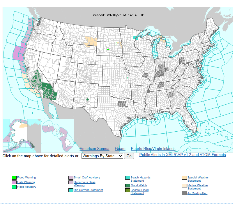
Post-Tropical Mario is pushing tropical moisture into Southern California, bringing the potential for locally heavy thunderstorms today and Friday. Rainfall totals of 1–3 inches, with rates over 1 inch per hour, may trigger flash flooding in sensitive terrain and urban areas. Flash Flood Watches are in effect across much of Southern California. New Mexico and Arizona may also see storms with localized flooding.
Elsewhere, much of the country will be warmer than average, with highs running 5–10°F above normal. The Ohio and Tennessee Valleys will be especially hot, reaching the lower to mid-90s. In contrast, the Southwest will be cooler with added clouds and rain. A backdoor cold front will cool the Northeast into the 60s and 70s this weekend.
Meanwhile, deep tropical moisture will fuel widespread showers and storms across southeast Florida. With urban areas most at risk, the Weather Prediction Center has issued a Marginal Risk for excessive rainfall and flash flooding.
Have a fantastic day!