
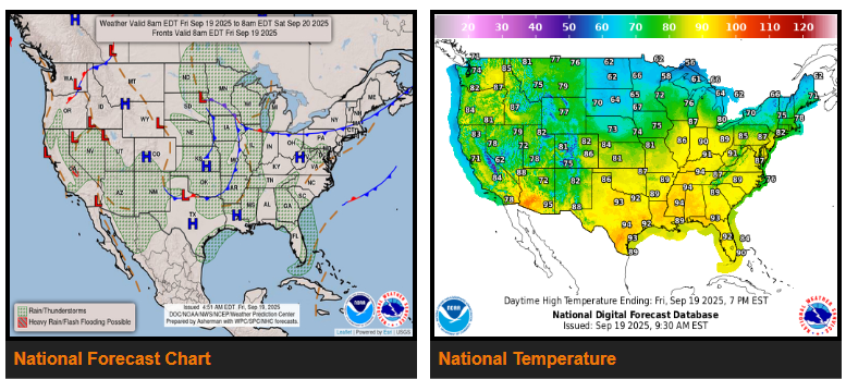
Remnants of Tropical Storm Mario will keep storms and heavy rain over California, the Great Basin, and the Southwest today, with a risk for flash flooding, especially in the Sierra Nevada. Storms taper off tonight, then shift north into the Rockies on Saturday with lighter rainfall.
In the central U.S., a slow-moving system will spark rounds of storms from the Midwest through the Plains into the weekend. Heavy rain and some flash flooding are possible, especially in the Upper Mississippi Valley, central Plains, and Ozarks. Scattered storms are also possible along the Gulf Coast, Southeast, and Appalachians.
By late Saturday, a Pacific system brings rain to the Northwest.
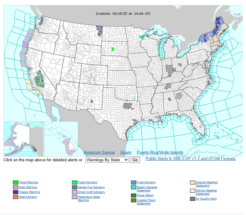
Temperatures will stay hot in the East, with highs in the upper 80s to mid-90s across the Mid-Atlantic, Ohio/Tennessee Valleys, Mississippi Valley, and Texas — as much as 15° above normal. In contrast, cooler air settles into the Northeast and Upper Great Lakes, with highs in the 60s and even frost/freeze warnings for interior New England. The Plains will be cool Friday, rebounding Saturday. Out West, temps stay below normal in California and the Great Basin (mostly 70s), while the Pacific Northwest warms into the 70s and 80s.
Have a fantastic day!