
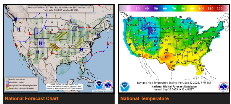
A series of storm systems will continue to bring rounds of thunderstorms from the Midwest and Ohio/Tennessee Valleys west into the Plains through mid-week. Gulf moisture fueling these storms will produce heavy rainfall, with the greatest risk for flash flooding today across western and south-central Kansas into northeastern Oklahoma. More isolated flooding is possible across the Ohio Valley, Mid-South, Ozarks, and Plains. Severe storms with large hail and damaging winds are also possible in parts of Kansas, Oklahoma, and the Texas Panhandle.
By Tuesday, the heavy rain threat shifts southeast into the Ozarks and Mid-South, with risks extending across the Ohio/Tennessee Valleys, Mississippi Valley, and southern Plains. Severe storms may also bring hail, damaging winds, and a few tornadoes. Flash flooding concerns will linger into Wednesday across the Ohio and Tennessee Valleys.
In the West, an upper low will spark thunderstorms Monday across Arizona, New Mexico, and the Colorado River Valley, with isolated flash flooding possible. By Tuesday, storms may reach central and southern California, with heavy rainfall posing risks near burn scars. Daily thunderstorms will continue for Florida, the Southeast coast, and parts of the western Gulf Coast. The Northeast will see showers and storms from a cold front moving through Monday and Tuesday, while the central Rockies may see showers with some high-elevation snow by Tuesday.
Temperatures will stay more like summer for much of the country early this week. Highs in the 80s and 90s will be common across the Southeast, Mississippi Valley, and southern Plains, with near 100 degrees possible in west Texas. The Northeast, Midwest, and northern Plains will see 70s and 80s. The West Coast will also warm, with highs in the 60s and 70s along the coast, 90s in California’s Central Valley, and near 100 in the Desert Southwest. Cooler, fall-like air will spread into the Rockies and central Plains by Tuesday, with highs dipping into the 50s and 60s.
WYOMING
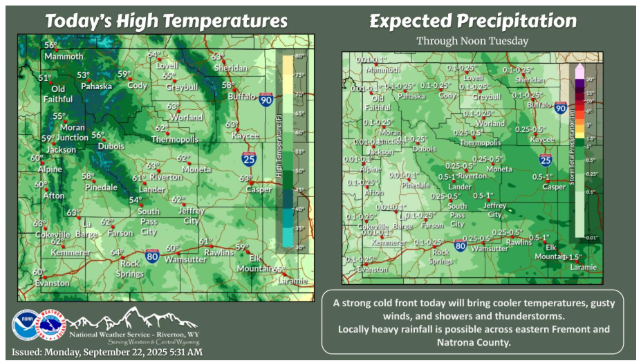
A cold front trekking across Wyoming will bring cooler temperatures, gusty winds, and shower and thunderstorm chances. Areas east of the Divide, especially eastern Fremont County and Natrona County, have the greatest chance of seeing locally heavy rainfall.
NEBRASKA
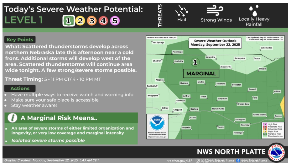
Scattered thunderstorms will be possible first across northern Nebraska this afternoon then spreading across the area tonight. A few storms could be strong to severe. Locally heavy rainfall will be possible with a few of the storms as well.
Have a fantastic day.