
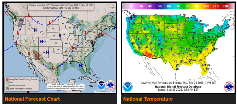
A strengthening southwest flow ahead of a cold front moving out of the Ohio Valley will pull Gulf moisture northward Thursday into Thursday night. This setup will bring scattered to widespread showers and thunderstorms across much of the eastern U.S. Heavy rainfall is possible along the front stretching from the Great Lakes to southern Texas, with localized flash flooding in urban, low-lying, and poor drainage areas. Some storms may become strong to severe from the Southeast through the Mid-Atlantic into southern New England, mainly producing damaging winds, though an isolated tornado cannot be ruled out. The front should clear the Northeast and Mid-Atlantic by Friday but will stall across the Southeast, keeping storms and a localized flood threat into the weekend.
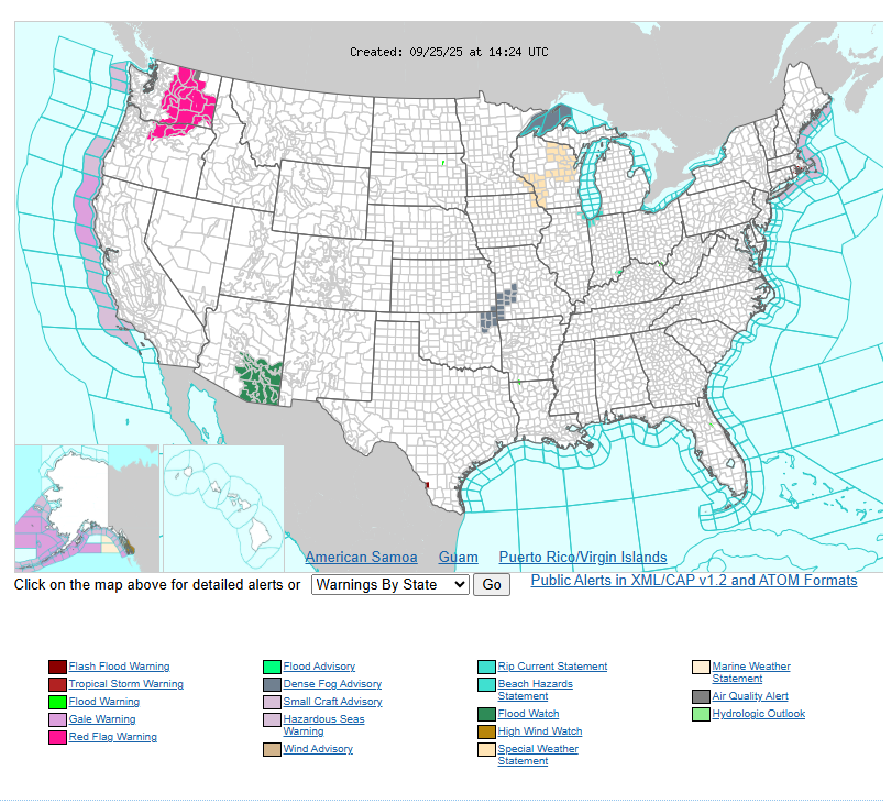
In the Southwest, a slow-moving upper-level low will funnel in moisture, fueling repeated rounds of storms through the weekend. Heavy rainfall could cause flash flooding, especially across southeast Arizona, southwest New Mexico, slot canyons, burn scars, and steep terrain. The flood risk will grow Friday and Saturday as saturated soils increase vulnerability.
Meanwhile, the Pacific Northwest faces critical fire weather conditions Thursday. Strong downslope winds of 20–25 mph, gusting to 35 mph, combined with very dry air and fuels, will create favorable conditions for rapid wildfire spread from the North Cascades into the Columbia Basin.
Have a fantastic day!