
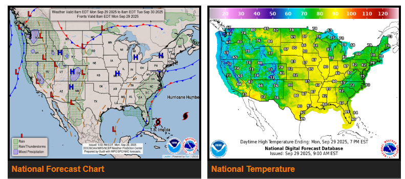
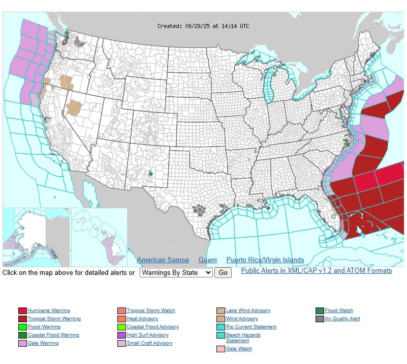
Tropical Storm Imelda is tracking across the Bahamas today into tonight and is expected to strengthen into a hurricane as it turns sharply east and heads out to sea Tuesday into Wednesday. While Imelda will remain offshore, some of its tropical moisture will interact with a stationary front along the Southeast coast, producing numerous showers and thunderstorms through midweek. Heavy downpours may cause localized flash flooding in low-lying or poor drainage areas, but the main risks will be swells, high surf, and dangerous rip currents along coastal areas of the Southeast and Mid-Atlantic.
Across the West, unsettled weather shifts from the Southwest into northern California and the Pacific Northwest as several Pacific storm systems move inland. Periods of showers and thunderstorms, with pockets of heavy rainfall, are expected from northern California and Nevada into Oregon, Idaho, and southwest Montana through Tuesday.
Meanwhile, strong upper-level ridging will drive unseasonably warm temperatures across the northern and central Plains, Upper Midwest, and Great Lakes. Highs will run 10–20°F above average, reaching the 70s, 80s, and even low 90s in some spots. Overnight lows will also stay warm, generally in the 50s and 60s.
WYOMING
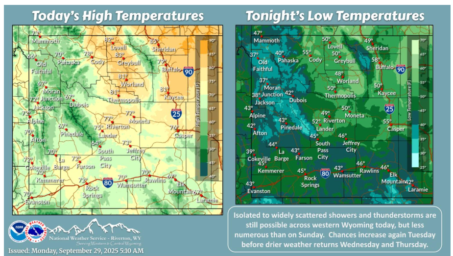
Showers and thunderstorms remain possible today, but more isolated than on Sunday and confined mainly to western Wyoming. Chances increase again on Tuesday with drier weather returning Wednesday and Thursday.
Have a fantastic day.