
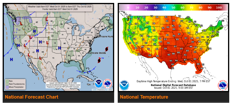
Tropical Storm Imelda has turned east-northeast in the southwest Atlantic and is now moving quickly out to sea. Behind it, strong high pressure will slide southward from Canada and settle over the Northeast and Mid-Atlantic by the end of the week. This system will bring dry conditions and much more fall-like temperatures across much of the eastern U.S. heading into the weekend.
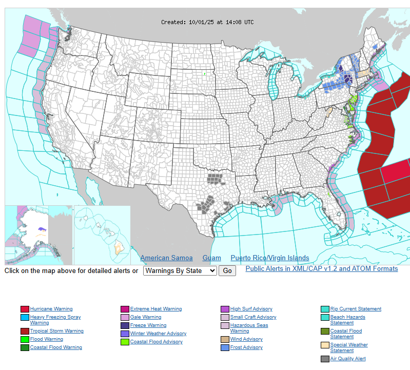
However, the southern edge of this high will keep strong easterly winds blowing onshore. Combined with wave action from both Imelda and Humberto, this will lead to swells, high surf, and dangerous rip currents along much of the East Coast for several days. Moisture from the onshore flow will also break the “mainly dry” pattern in the Southeast. Coastal areas of the Carolinas, Georgia, and especially Florida’s east coast can expect rounds of showers and thunderstorms. The repeated storms may bring isolated flash flooding into the weekend.
Out West, unsettled and cooler weather will persist in the Pacific Northwest, Great Basin, and Intermountain West as a series of systems move through. Moist Pacific flow will bring waves of showers and thunderstorms through the end of the week. Rain could even mix with snow in the highest elevations, while lower elevations may see periods of heavier rain. Although the flood risk is low, localized flash flooding remains possible in parts of the Great Basin, Sierras, northern Rockies, and Olympic Peninsula. Highs across the western U.S. will run 5 to 15 degrees below normal through Friday.
Meanwhile, a strong ridge over the central U.S. is fueling unseasonably hot conditions across the Plains and Midwest. The northern Plains and Upper Midwest will see the most extreme heat, with highs running 10–20 degrees above normal midweek and 20–30 degrees above normal by Friday. Several locations could tie or break daily records, including Minneapolis, MN, where a forecast high of 90°F on Friday would match the record set in 1997. For much of the central U.S., it will feel more like midsummer than early October.
WYOMING
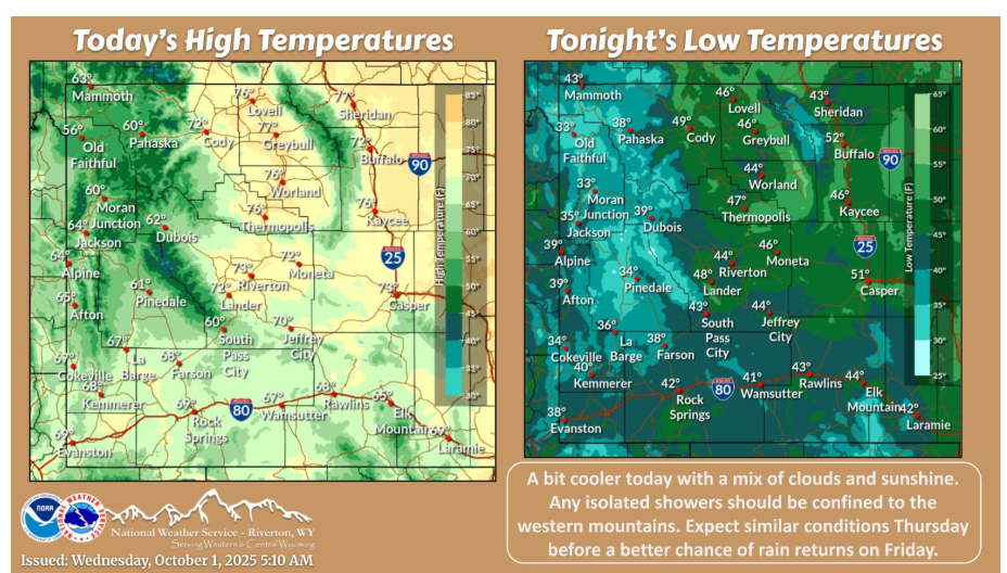
It will be a bit cooler today with a mix of clouds and sunshine. Any showers should be largely confined to the western mountains. Mainly dry weather continues Thursday with increasing rain chances on Friday.
Have a fantastic day.