
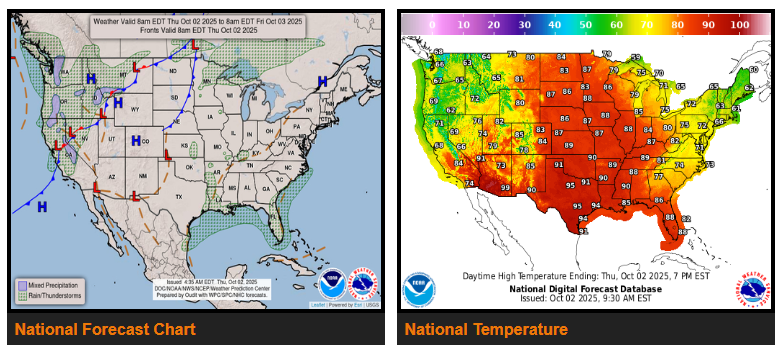
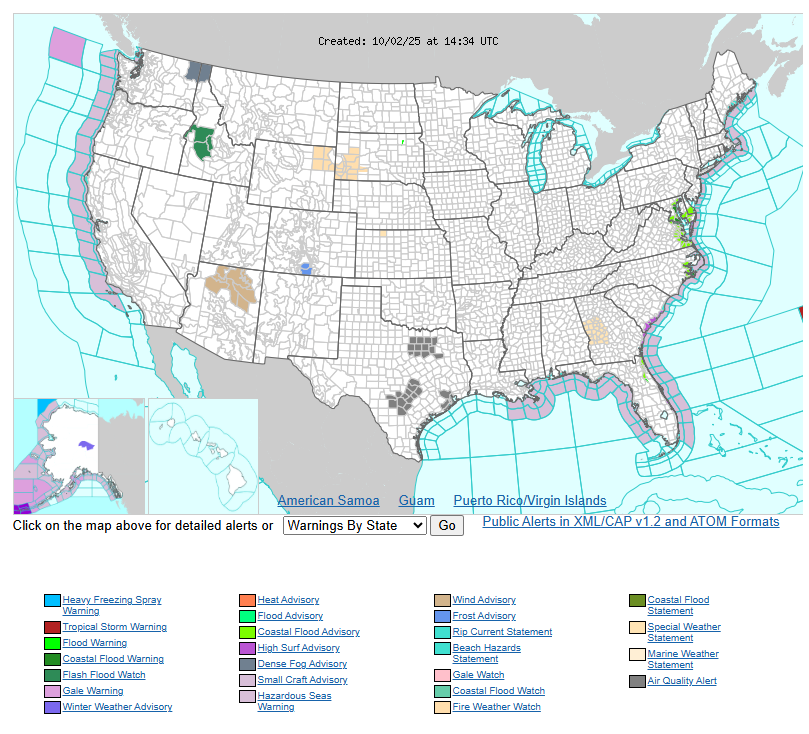
A strong high-pressure system is moving south from Canada and will settle over the Northeast and Mid-Atlantic through Friday, bringing much cooler, fall-like air. Farther south, this same system will drive steady easterly winds along the East Coast, creating swells, high surf, dangerous rip currents, and some coastal flooding over the next few days. The moist onshore flow will also fuel rounds of heavy showers and thunderstorms, especially along Florida’s east coast where 1 to 3 inches of rain—or more—are possible through Saturday. Localized flash flooding may occur in urban and poor-drainage areas.
Across the Pacific Northwest, Great Basin, northern Rockies, and Intermountain West, unsettled and cool conditions will continue as a strong upper-level trough digs into the region. Moist southwest winds ahead of the system will bring increasing showers and thunderstorms through Saturday. Higher elevations in the northern Rockies may even see some snow, while lower areas face periods of heavy rain and a risk of localized flash flooding. Temperatures will remain 10 to 20 degrees below normal across much of the West into the weekend.
Meanwhile, a strong ridge of high pressure will amplify over the central and eastern U.S., bringing unseasonably hot conditions to the Plains and Midwest. The northern Plains and Upper Midwest will feel the brunt of the heat, with highs running 20 to 30 degrees above normal Friday and Saturday, topping out in the upper 80s to low/mid 90s. Record-breaking highs and warm overnight lows are possible. Despite the calendar turning to October, summer-like weather will dominate much of the central U.S. into the weekend.
WYOMING
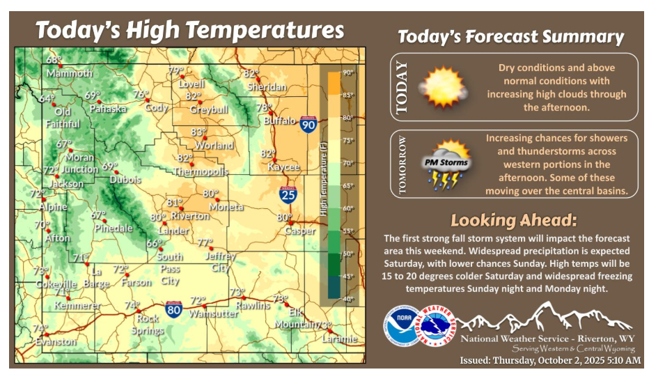
Dry conditions and above normal temperatures continue across the area today. Increasing chances for showers and storms will occur across western portions Friday afternoon. Some of these will spill into the central basins late in the afternoon into the evening.
Have a fantastic day.