
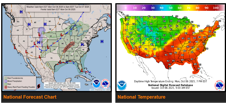
A strong cold front is moving across the Midwest into the southern Plains, bringing heavy rain and possible flash flooding through tonight in parts of the Lower Mississippi Valley, Mid-South, and Lower Ohio Valley — especially across Kentucky, where 3–5 inches of rain are possible. The system will shift east Tuesday, spreading rain into the Great Lakes, Northeast, and Mid-Atlantic, though amounts will be lighter.
Drivers in the Gulf Coast and Florida should expect continued showers and storms with localized flooding, mainly in urban areas. New Mexico may also see scattered storms and isolated flash flooding near burn scar regions.
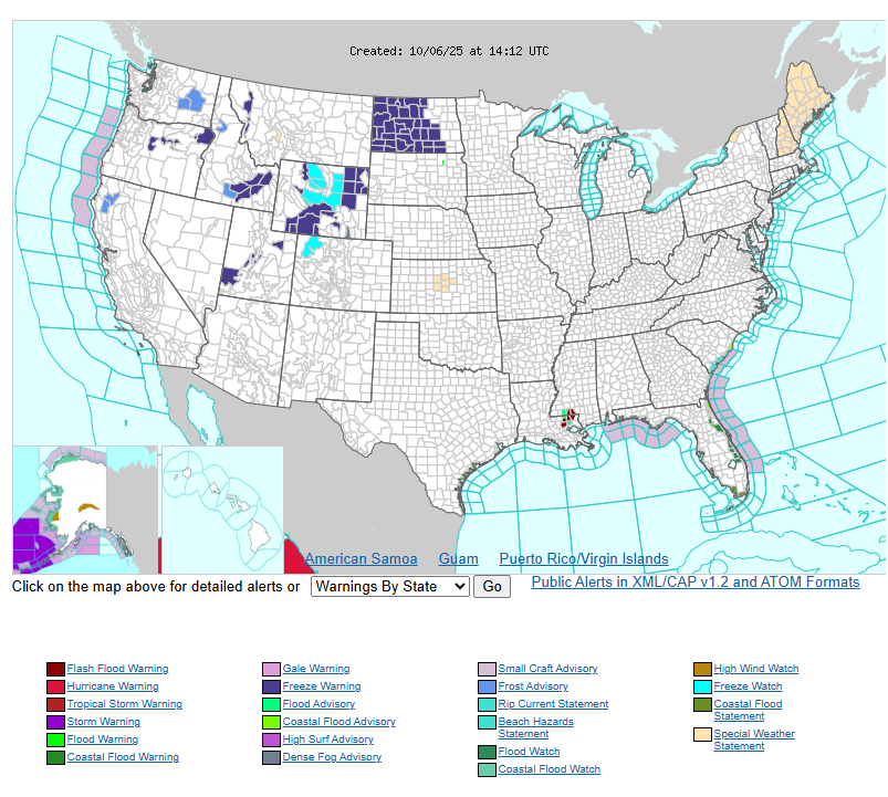
Behind the front, much cooler air will spread across the Plains and Rockies. Highs will drop into the 50s and 60s from Wyoming through the central Plains, with freeze warnings and frost advisories in parts of the Intermountain West and north-central U.S. Warmer-than-normal conditions continue to the east, with highs in the 80s across the Midwest, Great Lakes, and Northeast today.
WYOMING
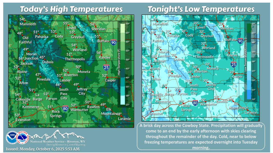
The weekend system is making its way out of the area today. However, a few showers will linger through the morning. Skies are expected to gradually clear throughout the day with below normal highs and chilly temperatures tonight into Tuesday morning.
NEBRASKA
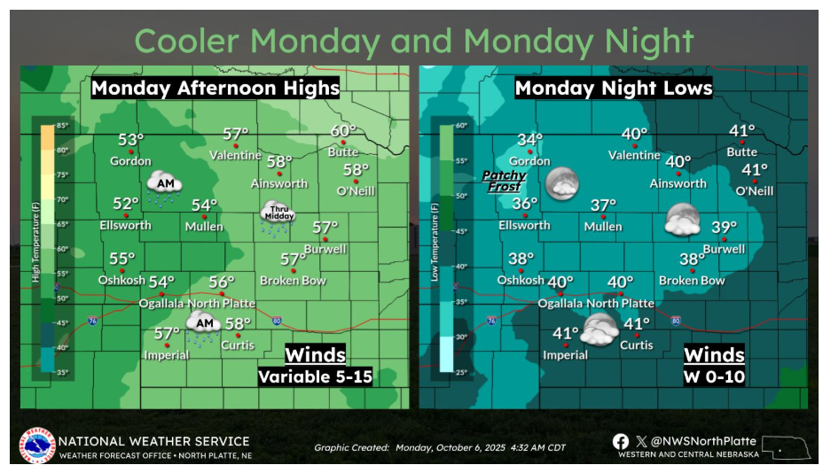
A noticeable cool-down arrives Monday following the warm and windy weekend. Highs will only reach the low to upper 50s across western and north central Nebraska, with a few lingering showers in the morning and midday. By Monday night, skies begin to clear and winds relax — allowing temperatures to drop into the 30s and low 40s. Patchy frost will be possible across northern areas, especially in sheltered valleys.
Be alert for slick roads, reduced visibility, and changing temperatures along your routes.