
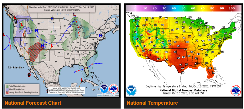
Moisture from Tropical Cyclone Priscilla will move north into the Southwest and Great Basin Friday, bringing widespread showers and heavy thunderstorms. A Moderate Risk (level 3/4) of excessive rainfall is in effect, with potential for flash flooding, rising streams, and debris flows near burn areas.
Heavy rain will continue Saturday across parts of the Southwest and Central/Southern Rockies, with a Slight Risk (level 2/4) for flash flooding, especially in urban and low-lying areas.
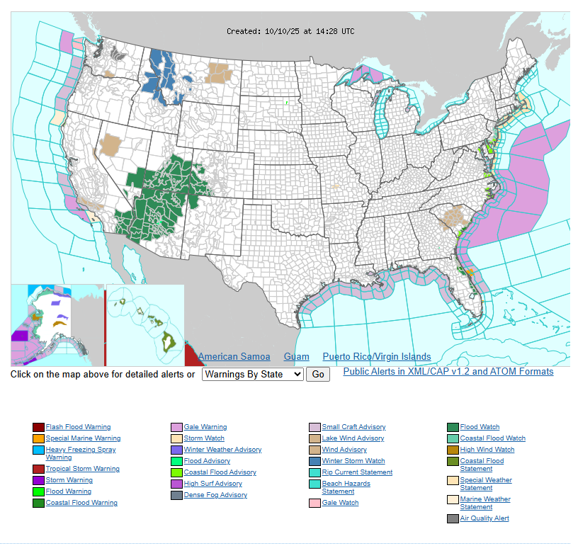
In the Northwest, an incoming storm system will bring rain and mountain snow through the weekend, with heavier snow expected in the Cascades and Northern Rockies.
Meanwhile, a developing system along the Southeast Coast will bring heavy rain and storms from Florida to the Carolinas Friday through Sunday, with localized flooding possible.
Rain is also expected across parts of the Great Lakes into the Northeast through the weekend.
WYOMING
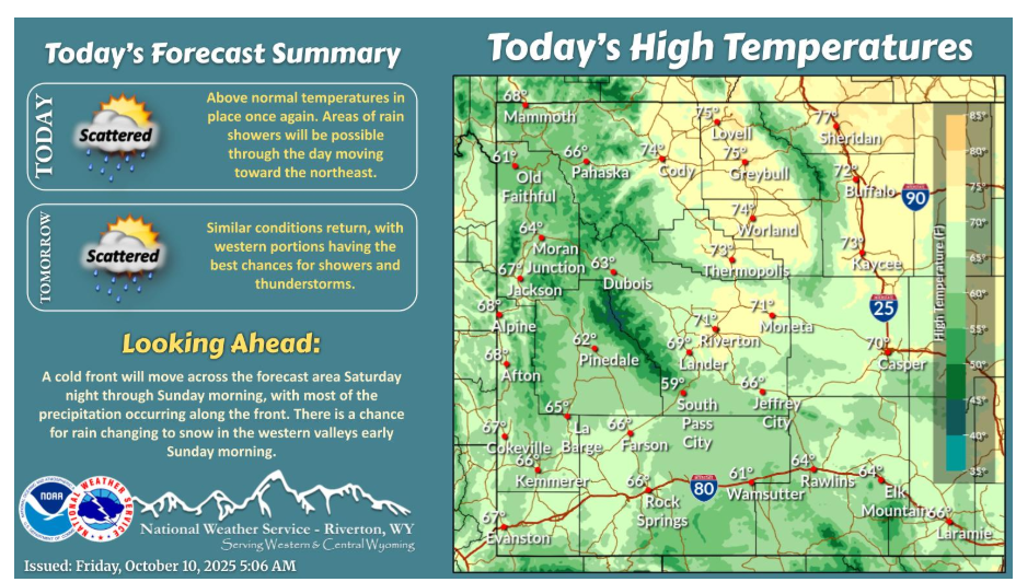
Showers will continue to increase from the south this morning, spreading to the northeast through the day. Similar conditions return Saturday, with western portions having the best chances for precipitation, as a cold front approaches.
Have a fantastic day.