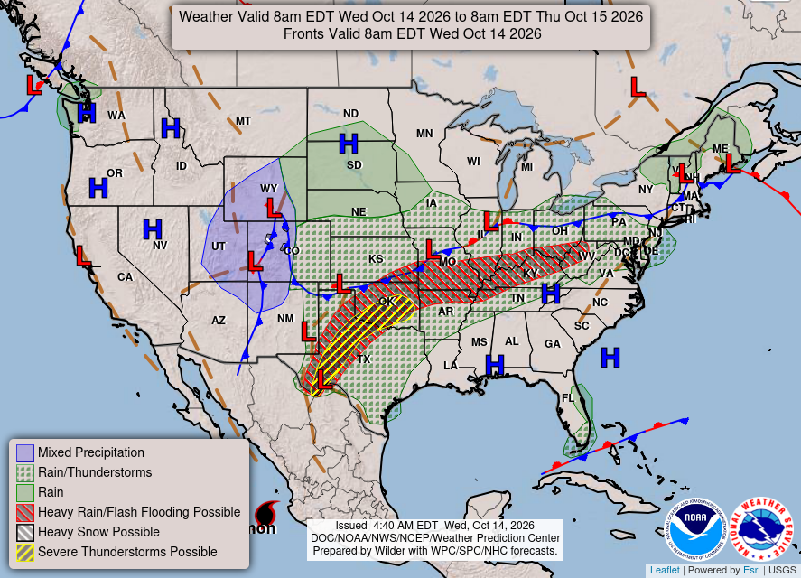
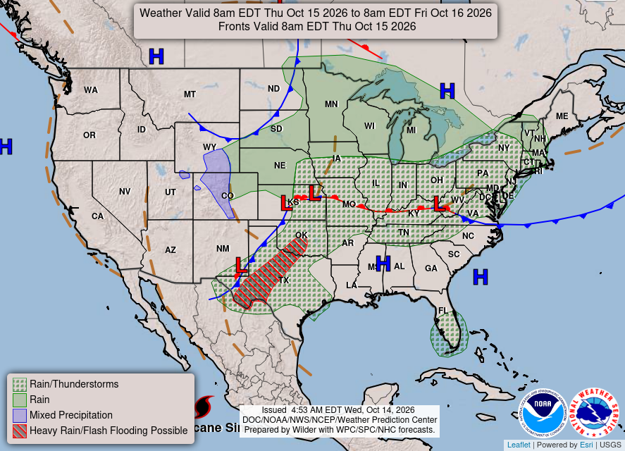
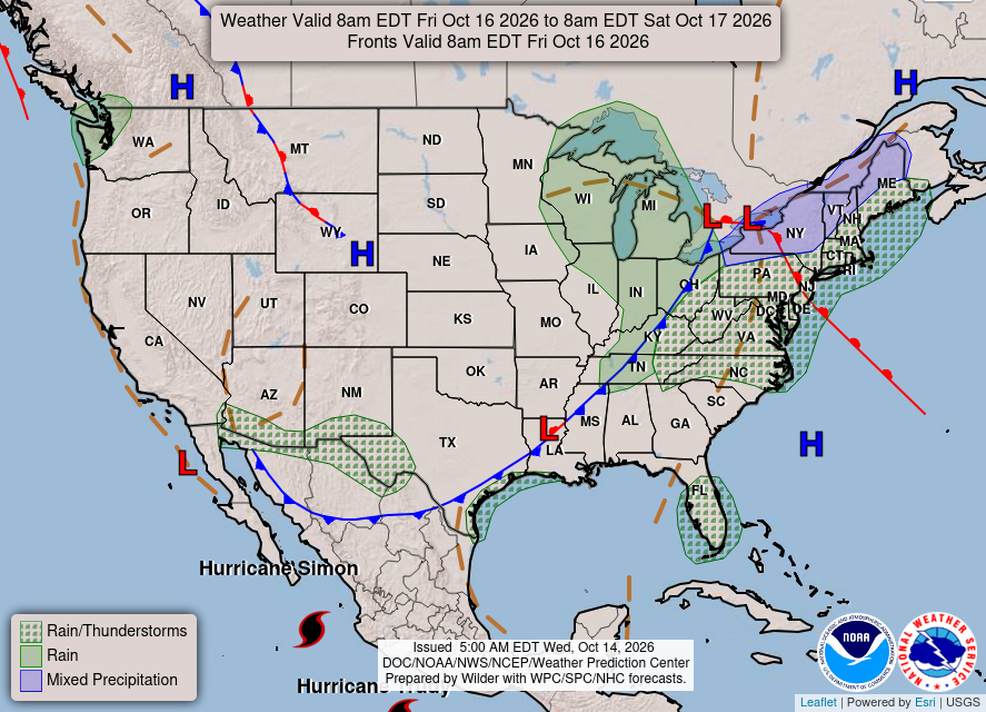
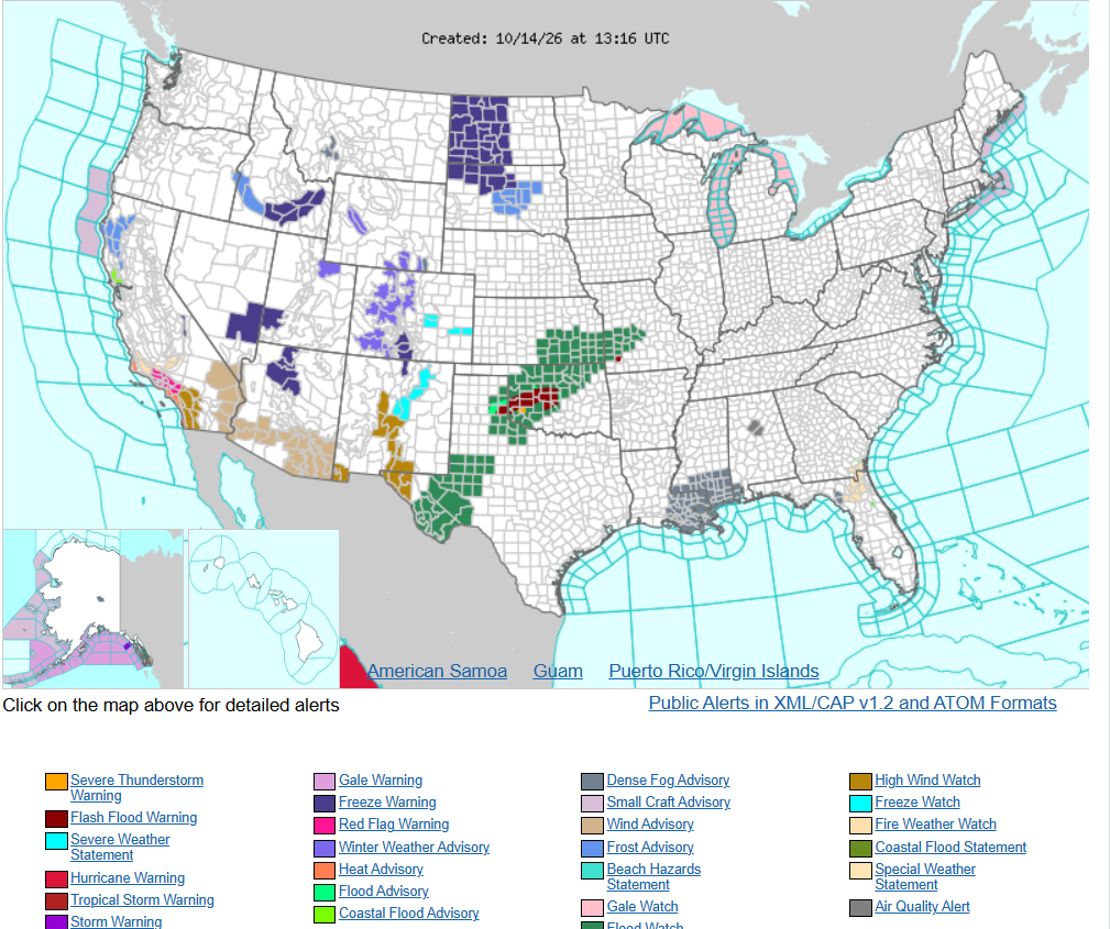
Heavy rain and widely scattered severe storms are expected over portions of the central and southern Plains into the Ohio Valley. Unseasonable warmth will continue for a few more days across the Midwest, Southeast, and Mid-Atlantic where several daily record highs could fall.
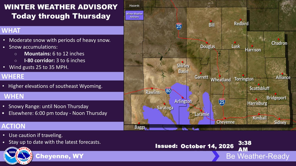
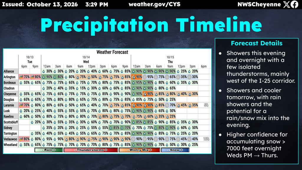
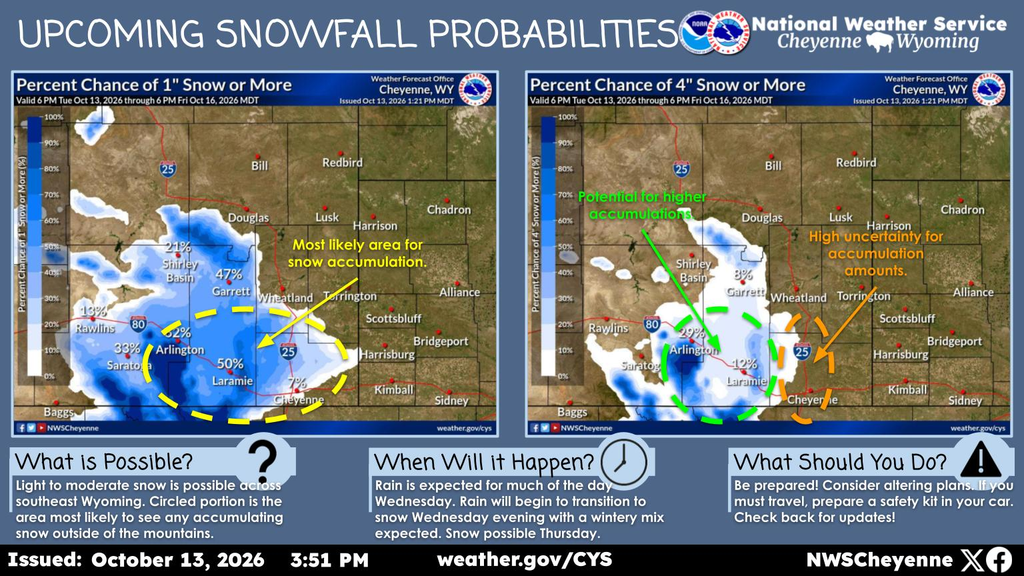
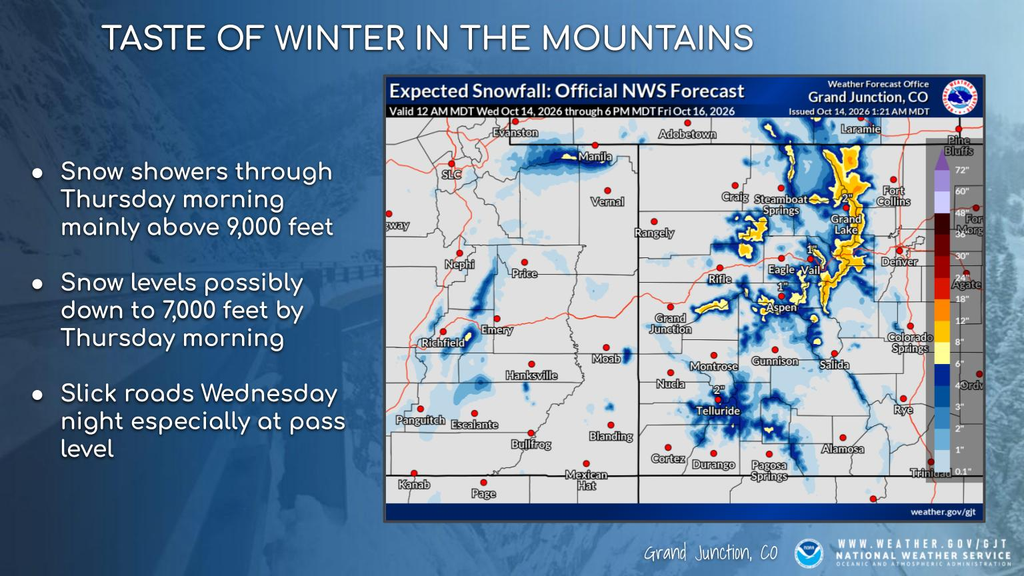
This upcoming system will bring widespread precipitation to the area on Wednesday and Thursday. Scattered rain showers are expected across both southeast Wyoming and western Nebraska during the day Wednesday. Rain will begin to transition to a wintery mix/snow during the evening hours on Wednesday for areas along and west of the Laramie Range. Snow could push into the Interstate 25 corridor late Wednesday night/Thursday morning as temperatures fall. Locations above 7000 feet are most likely to see snow and possible accumulations. Snow accumulations are most uncertain along the Interstate 25 corridor. Travel could become hazardous near Arlington and the Interstate 80 summit Wednesday night into Thursday morning as snowfall accumulations are likely in these areas. Precipitation will continue Thursday morning but will begin to taper off during the afternoon hours.