
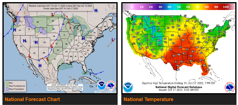
Showers and storms are expected to increase from Arkansas to Michigan through the weekend as a new weather system moves across the Midwest. The heaviest rain—1 to 3 inches—could fall from central Illinois to northern Indiana, possibly leading to some flooding.
A Slight Risk for severe storms is in place Saturday from the ArkLaTex region to western Kentucky, with potential for damaging winds, hail, and a few tornadoes.
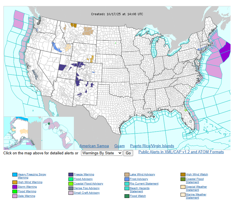
Farther east, it will stay cool and crisp across the Mid-Atlantic and Northeast, with some frost and freeze advisories in effect.
Out west, rain returns to Washington state by late Saturday, while the Southwest and East Coast remain mostly dry and calm under high pressure.
WYOMING
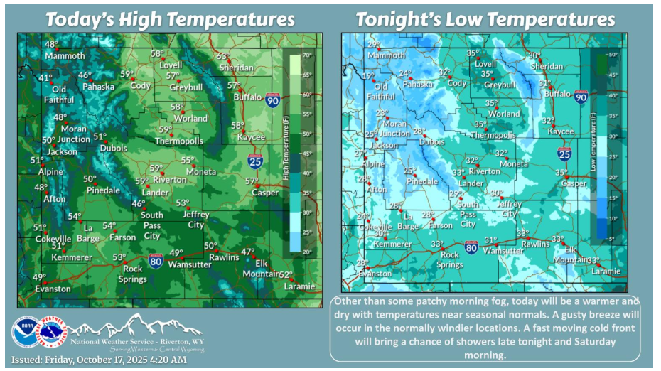
A seasonable and dry day is expected today. A gusty breeze will occur in the favored locations. A cold front will bring showers mainly along and East of the Continental Divide late tonight and Saturday morning.
NEBRASKA
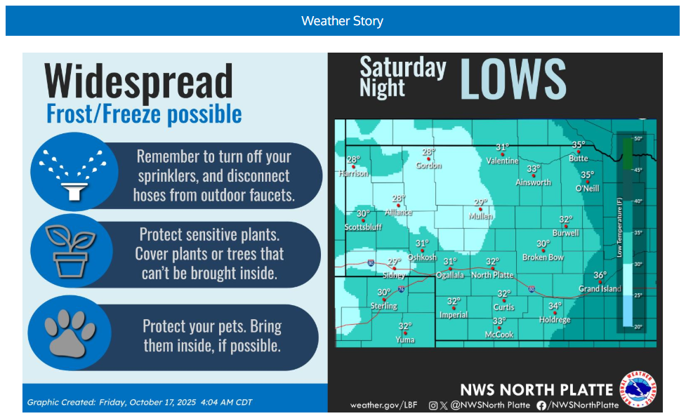
Forecast confidence in freezing temperatures and widespread frost Saturday night, continues to increase. Overnight lows Saturday night will range from the upper 20s to lower 30s.
Have a fantastic day.