
Good morning,
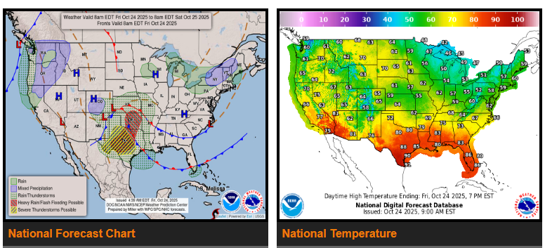
Widespread showers and thunderstorms will bring a flash flood and severe weather threat from the southern Plains to the Lower Mississippi Valley through Saturday. Heavy rain could reach 2 inches per hour, with several rounds of storms likely. Flash flooding, large hail, damaging winds, and a few tornadoes are possible across Texas, Louisiana, and the ArkLaTex region.
Out West, a Pacific storm system will bring heavy coastal rain and mountain snow to the Pacific Northwest and northern California this weekend. Flooding could occur in low-lying areas, and several inches of snow are expected in the higher elevations of the Cascades and Olympics.
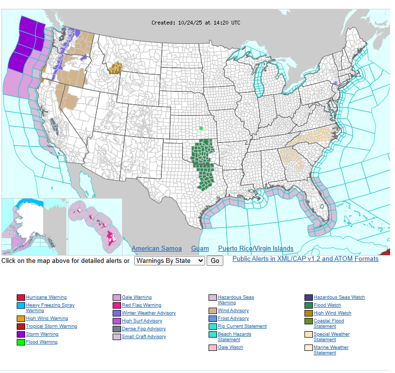
Elsewhere, lake-effect showers will continue near the Great Lakes, while the rest of the country stays mostly dry. Cooler temperatures are expected across the Great Lakes, Ohio Valley, and East Coast, with widespread frost and freeze warnings. Warmer weather continues in the southern Plains and Texas, while the northern Plains see above-average highs before cooler air moves in this weekend.
WYOMING
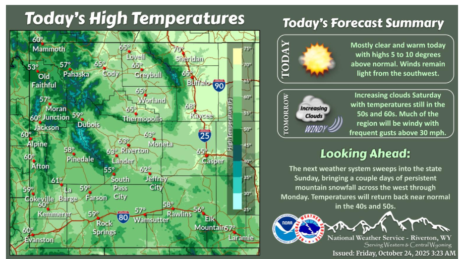
Unseasonably warm conditions for late October continue today and Saturday, with highs in the 50s and 60s. The next weather system moves into the western mountains late this weekend, with more snow expected.
Cold and wet conditions return Saturday night as a storm brings accumulating mountain snowfall to western Wyoming. Here’s a look at what accumulations might look like at several locations through Monday night. Be prepared for winter travel conditions if driving over the mountains.
Have a fantastic day.