
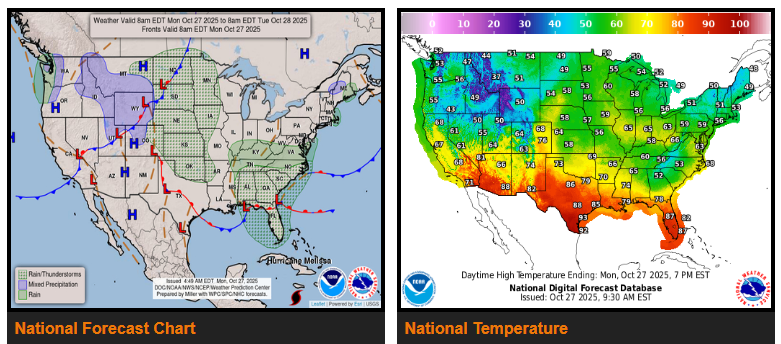
Cool, unsettled weather continues across the Southeast and southern Appalachians today, with scattered showers and isolated flash flooding possible in parts of Georgia and the Carolinas.
A new storm system will develop by midweek across the Middle and Lower Mississippi Valley, bringing widespread showers and thunderstorms from Arkansas to Tennessee and northern Mississippi.
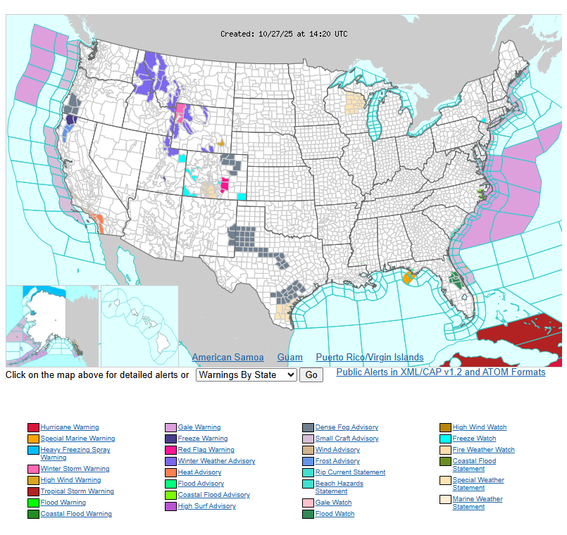
The Pacific Northwest will see more rain and mountain snow Tuesday, while south Texas stays hot with highs near 100°. Southern California will also warm into the 80s and 90s under Heat Advisories.
Cooler air spreads through the Southeast and Plains early this week, with highs mostly in the 50s and 60s, while much of the West remains below average.
WYOMING
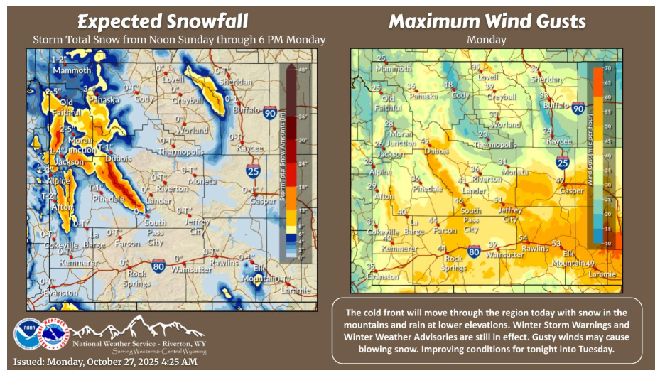
The cold front will continue to move across the Cowboy State today. Tonight into Tuesday will see improving, though chilly weather. Snow, heavy over the mountains and low level rain will diminish this afternoon and evening. Gusty winds will continue.
NEBRASKA
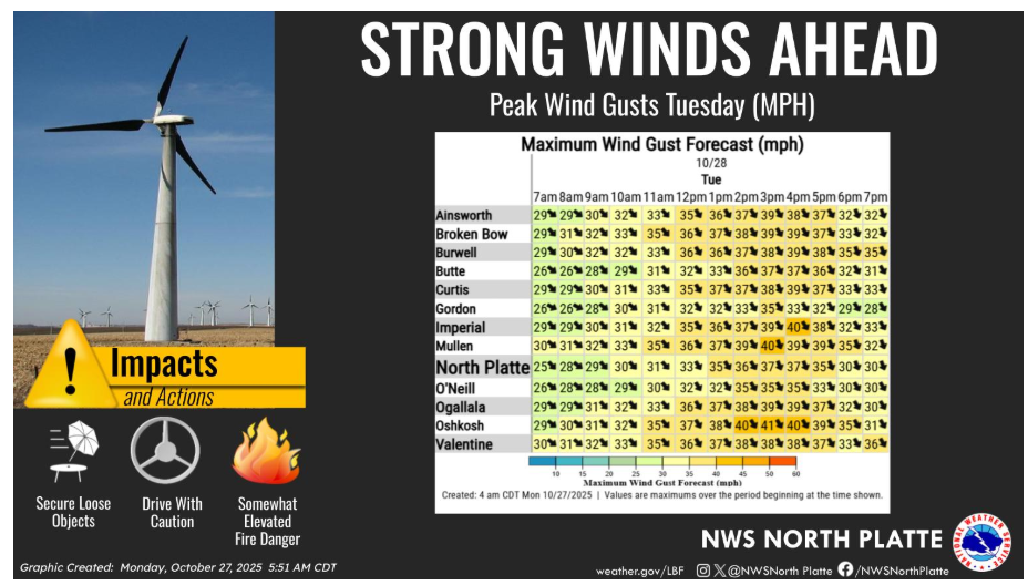
Strong and gusty northwest winds will develop Tuesday behind a cold front. Gusts of 35 to 45 mph will be common from late morning into the afternoon hours. Somewhat elevated fire weather conditions are expected west of Highway 183. Cooler temperatures, and only marginally low humidity will minimize the overall threat, however.
Have a fantastic day.