
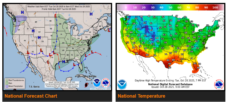
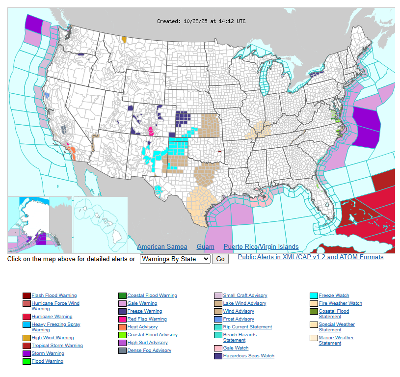
Showers and thunderstorms will continue Tuesday across the Carolinas and southern Mid-Atlantic, bringing gusty coastal winds and possible flooding along the Outer Banks.
A strong storm system will move from the Mississippi Valley through the Appalachians into Wednesday, with widespread rain and thunderstorms from Mississippi and Tennessee up through Kentucky, Ohio, and the Carolinas. Expect cooler temperatures in the 50s and 60s across most of the central and eastern U.S.
Out West, another Pacific system will bring rain and mountain snow to Washington and Oregon, while California and the Southwest warm into the 80s and 90s.
WYOMING
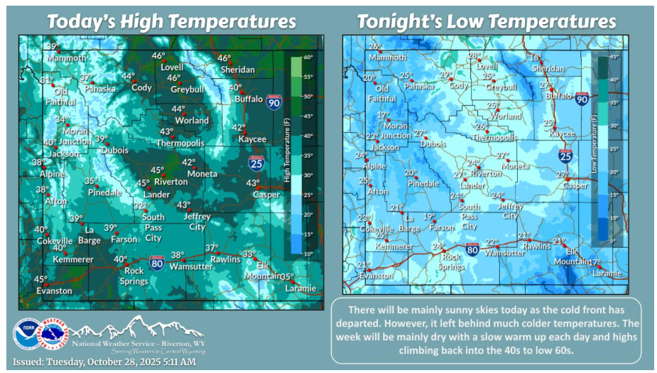
The cold front has exited the area and left colder temperatures behind. It will be mainly dry with sunny skies all through the week. There will be a slow warm up over the next several days with highs climbing back into the 40s to low 60s.
Drive safe and stay weather-aware!