
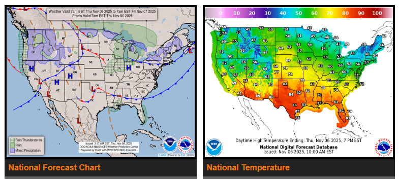
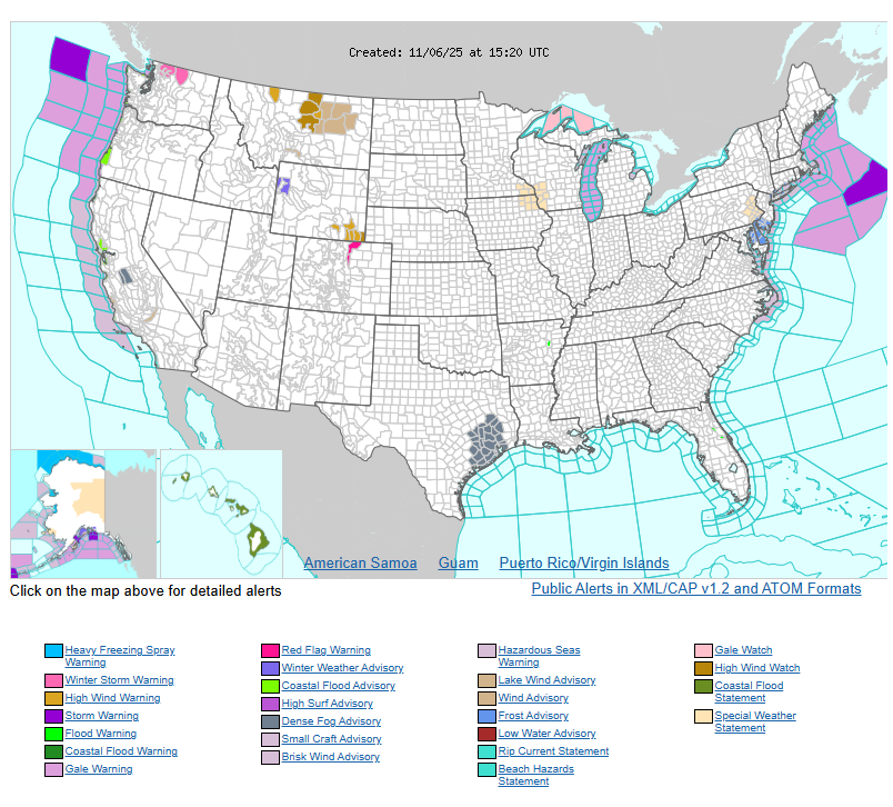
Unsettled weather will continue for the Pacific Northwest and Northern California, bringing heavy rain to the coastal ranges and heavy snowfall over the higher elevations of the Cascades through early Friday. A few additional inches of rainfall are expected with this latest Pacific moisture surge, which could cause isolated flooding in some areas. The higher elevations of northern Washington may see 12 to 18+ inches of snow. Some of this moisture will also spread into the northern Rockies, bringing locally heavy snow as the next Pacific front moves through the Intermountain Region.
High pressure will dominate much of the Southwest U.S. and the southern Plains, keeping conditions warm and dry. Temperatures will remain above normal for this time of year.
By late Friday and into Saturday, a strong cold front moving in from Canada will bring a sharp drop in temperatures across the Dakotas and into the Upper Midwest. This will set the stage for a much colder start to the weekend, with below-normal temperatures and a chance for light snow north of the low-pressure track.
Farther east, cooler air will settle over the Northeast on Thursday following a departing low-pressure system and trailing cold front. Temperatures there will be below normal. On Friday, a new set of cold fronts will move from the Midwest into the Eastern U.S., spreading rain across the Great Lakes and Northeast. Ahead of these fronts, showers and thunderstorms are expected to develop across the Ohio and Tennessee Valleys and down to the central Gulf Coast. Some of these storms may become severe, especially across south-central Kentucky and middle Tennessee, where a Slight Risk (level 2/5) is in place for large hail and gusty winds. These fronts should reach the East Coast by early Saturday.
WYOMING
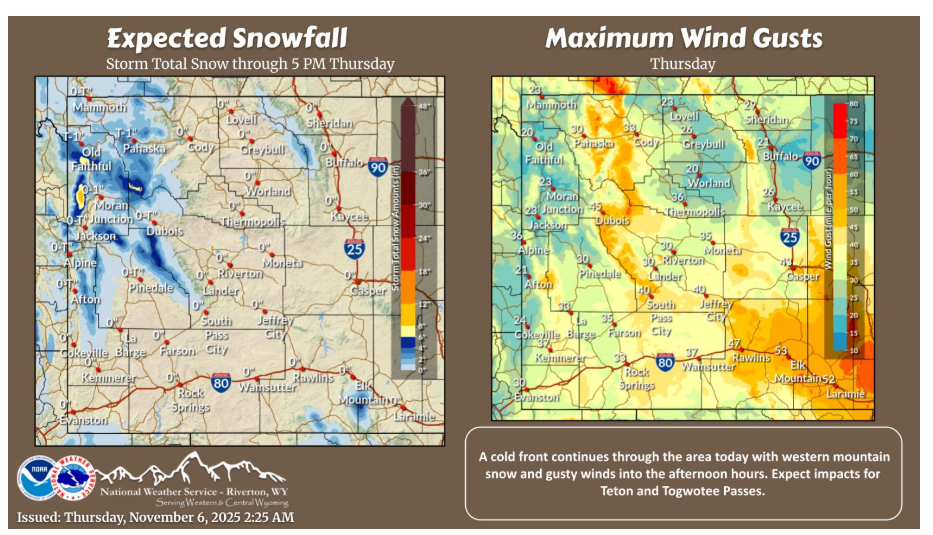
A cold front continues through the state today with western mountain snow and gusty winds to be had. Teton and Togwotee Passes will see the best chances for impacts through the afternoon today. Take precautions and drive safe!
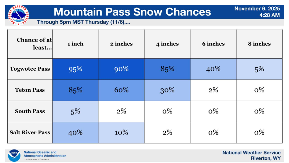
Snow accumulation chances for some of the mountain passes through this afternoon, with Togwotee and Teton Passes to see the most impact, drive safe today!
Have a fantastic day.