
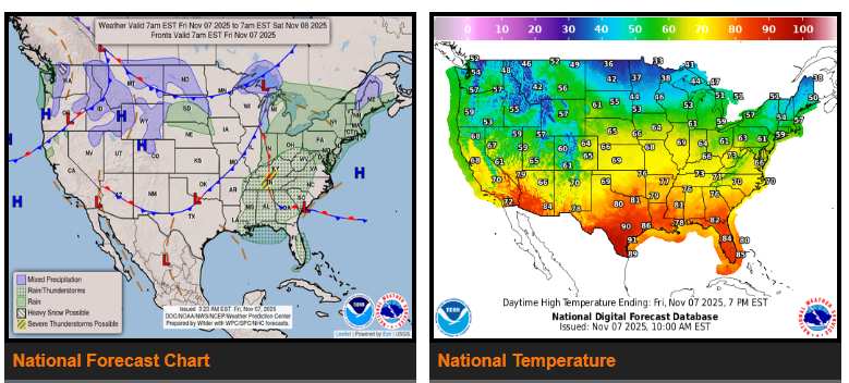
Unsettled weather continues across the northern states, with rain and storms expected tonight over parts of the Tennessee and Ohio Valleys. Frigid air will move south from Canada into the Great Plains and Mississippi Valley this weekend. A strong upper-level system over southern Hudson Bay will drive several waves of low pressure through the central and eastern U.S., bringing a mix of rain, storms, and snow to many areas.
Scattered thunderstorms are expected today across the Tennessee and Ohio Valleys, with a slight risk of severe weather. Rain showers will move through the Northeast and Mid-Atlantic, with some snow mixing in over northern New Hampshire and Maine tonight. Another Arctic front will follow, bringing additional rain and storms to the East Coast and a mix of rain and snow to the Midwest from Saturday into Sunday.
Across the Northwest, a wave of low pressure will spread mixed precipitation today, moving into the Northern and Central Plains and the Great Lakes region through the weekend. Behind this system, strong winds and frigid air will spill south across the Great Plains and Mississippi Valley starting Saturday.
Texas will stay warm and dry through Saturday, with highs in the 80s and 90s—10 to 20 degrees above normal. Some areas in southern Texas may break record highs before temperatures drop sharply Sunday as the Arctic front moves through. Along the East Coast, conditions will remain mostly dry and seasonably warm through the weekend.
Drivers should be prepared for colder temperatures, strong winds, and possible snow in the Plains and Midwest by late weekend, while southern routes remain warm until Sunday.
WYOMING
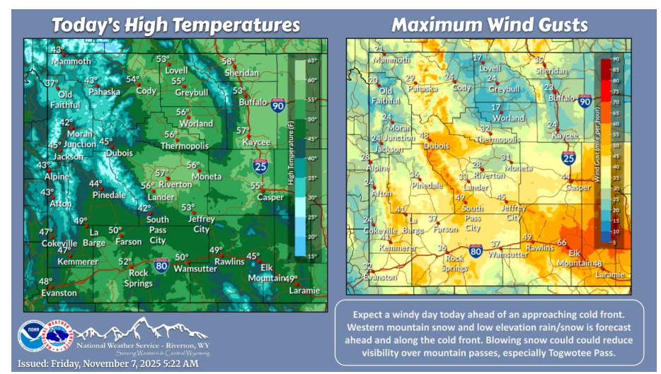
Another windy day is in store across the area ahead of an approaching cold front later this evening. Ahead of the front, expect western mountain snow as well as rain/snow for low elevation areas. Areas east of the Divide could see rain/snow with cold front passage. Take it slow over mountain passes!
Have a fantastic day.