
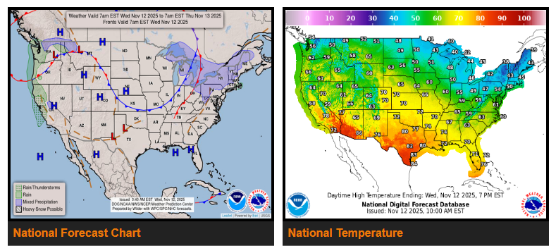
Temperatures are moderating in the East, while the Central and Western U.S. continue to warm up.
Light snow will persist across the Lower Great Lakes and interior parts of the Northeast through Thursday, as westerly winds bring lingering lake-effect snow. The strong winds and frigid temperatures in the East will ease as the polar air mass lifts north.
Across the Central U.S., an upper ridge is moving in, bringing much warmer air. Highs in the 60s and 70s—around 20–30 degrees above normal—are expected across the Northern and Central Plains on Thursday and Friday.
Out West, a strong storm system developing off the coast will bring heavy rain, mountain snow, and strong winds starting tonight. The heaviest precipitation is expected in California on Thursday.
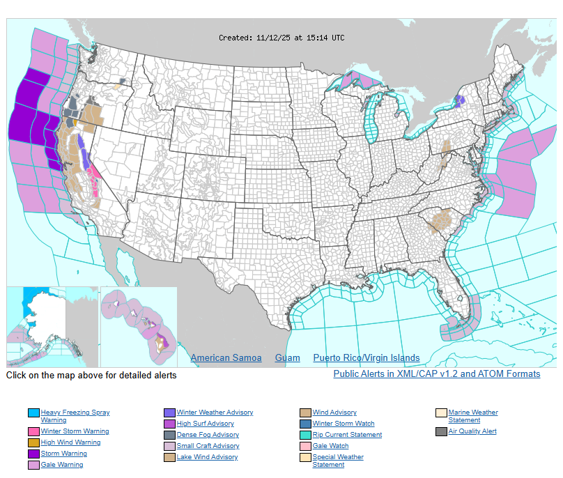
- Winter Storm Warnings: Southern Sierra
- Winter Weather Advisories: Northern Sierra
- High Wind Warnings: Coastal California and southern-central Oregon
There’s also a slight risk (15%) of excessive rainfall for the Bay Area and Sierra foothills Thursday, with possible flash flooding as far south as Los Angeles. Warmer southern air will keep much of the West above average for the next few days.
WYOMING
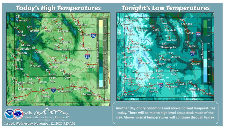
Mostly cloudy and remaining mild today. Above normal temperatures will continue through Friday. The next chance of showers move into western Wyoming during the day on Friday.
Have a fantastic day.