
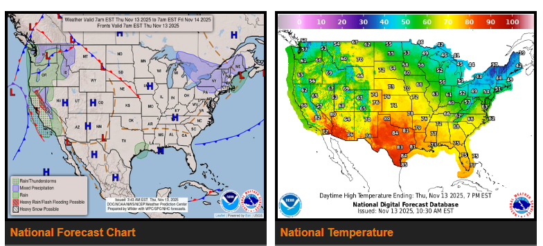
Snow will continue across the Lower Great Lakes and interior Northeast/New England through the weekend.
Above-average temperatures persist across the West and Central U.S., while a strong storm system develops off the West Coast, bringing heavy rain, mountain snow, and strong winds to California through Saturday.
Cool westerly flow over the Great Lakes and interior Northeast will maintain lake-effect snow showers into the weekend.
Meanwhile, ridging over the West and Central U.S. will support unseasonably warm conditions. Highs in the 60s could set records across the Northern Rockies, while lows in the 40s across the Northern Plains are running 20–30°F above normal. Cloudy, rainy conditions in the Southwest will keep lows in the 50s–60s, also near record levels. As the upper trough approaches the West Coast, southerly flow will bring even warmer temperatures to the Great Plains Friday, with many locations 20–30°F above average.
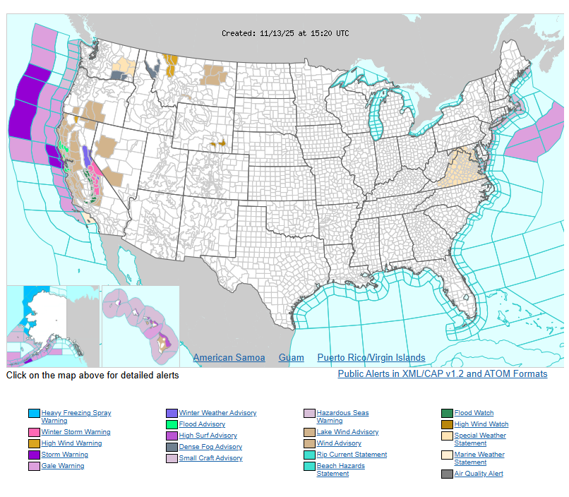
The strengthening Pacific storm will bring widespread heavy rain and wind to California today and Friday. A Slight Risk (15%) of flash flooding is in effect for the Bay Area and upslope regions of the Sierra Nevada today, shifting south to northern Los Angeles County and the Transverse Ranges Friday. Heavy mountain snow is expected in the southern Sierra, where 1–2 feet may accumulate by Saturday morning.
High Wind Warnings and Advisories are posted for much of northern and central California and western Nevada, with gusts up to 55 mph possible. Strong southwest winds (40–55 mph) will also impact eastern Glacier National Park and nearby foothills through Friday due to a separate low over south-central Canada.
WYOMING
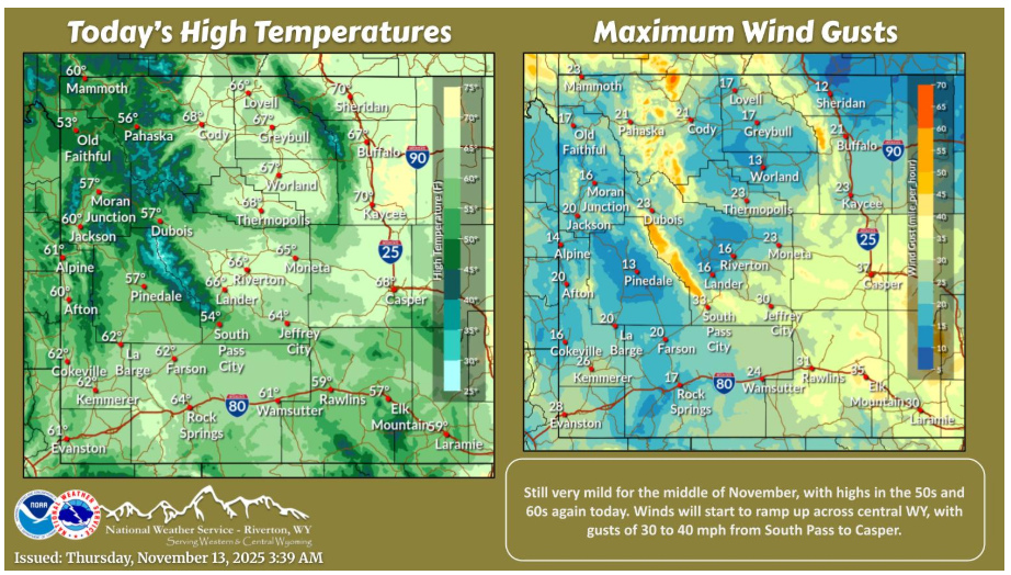
Still very mild for the middle of November, with highs in the 50s and 60s again today. Winds will start to ramp up across central WY, with gusts of 30 to 40 mph from South Pass to Casper.
Have a fantastic day.