
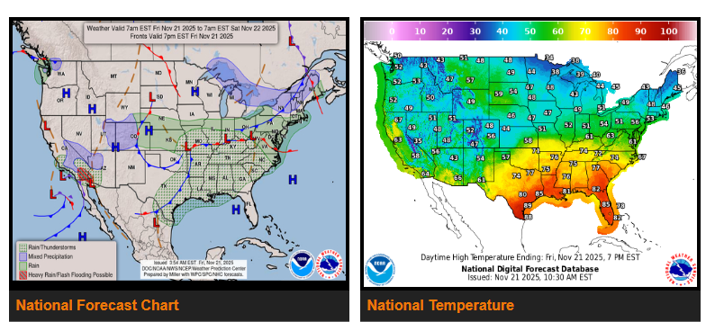
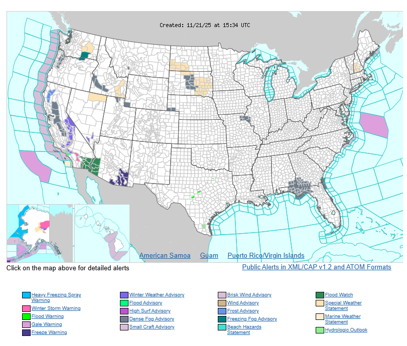
Heavy rain and flash flooding remain a concern today and Saturday for southern California, western Arizona, and southern Nevada.
Record warmth will continue along the Gulf Coast, lower Mississippi Valley, and into the Southeast, while arctic air stays well north of the Lower 48.
A very active southern jet stream will keep a broad stretch of the country in a wet weather pattern over the next few days. Moisture will extend from Southern California and the Desert Southwest through the central and southern Plains, Mid-Mississippi Valley, Ohio Valley, and Mid-Atlantic.
A developing low-pressure system in the central Plains is producing heavy rain and thunderstorms, with the greatest flash-flood risk in the Arklatex region. As this system moves east, it will bring light to moderate rain from the central Plains to the Ohio Valley, central Appalachians, and Mid-Atlantic through Saturday morning. The Deep South may also see thunderstorms, though the flash-flood threat there is low. By Saturday, scattered showers and storms are expected across the Southeast and Mid-Atlantic before the system and its cold front push offshore Saturday night (except for Florida).
In the Southwest, two back-to-back low-pressure systems will bring more heavy rain and flash-flooding potential today and Saturday. The first system is already delivering moderate to heavy rain across southern California. Although it will weaken near Los Angeles, the rainfall will fall on areas already soaked earlier this week, increasing flood risk—especially over burn scars and urban areas.
A second system will quickly form over the Pacific and may take on subtropical characteristics as it moves toward Baja California on Saturday. Most of its heaviest rain should stay over Mexico, but by late Saturday, showers and thunderstorms will expand into Arizona and reach New Mexico by Sunday morning. Higher elevations may see wet snow. The Pacific Northwest will also see rain arriving early Sunday ahead of another frontal system.
While the southern jet stays active, the northern jet remains mostly west-to-east, keeping arctic air out of the Lower 48. Most of the country will see above-average temperatures into the weekend. The cooler exceptions will be central and southern California and parts of the Southwest, where clouds and rain keep temperatures lower. Slightly cooler-than-average temperatures are also possible in the Northeast and New England.
Meanwhile, record warmth will continue along the Gulf Coast, lower Mississippi Valley, and Southeast, with both overnight lows and afternoon highs running well above average.
WYOMING
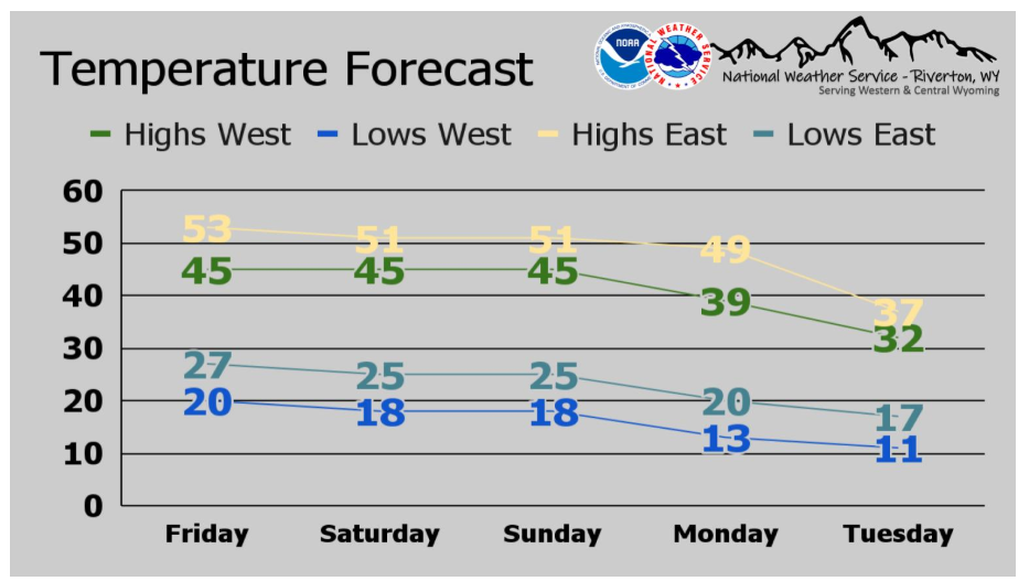
Above normal temperatures will continue through this weekend, but a big cooldown is on the way next week! Take a look at the average highs and lows for west and east of the Continental Divide over the next 5 days.
Have a fantastic day.