
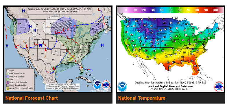
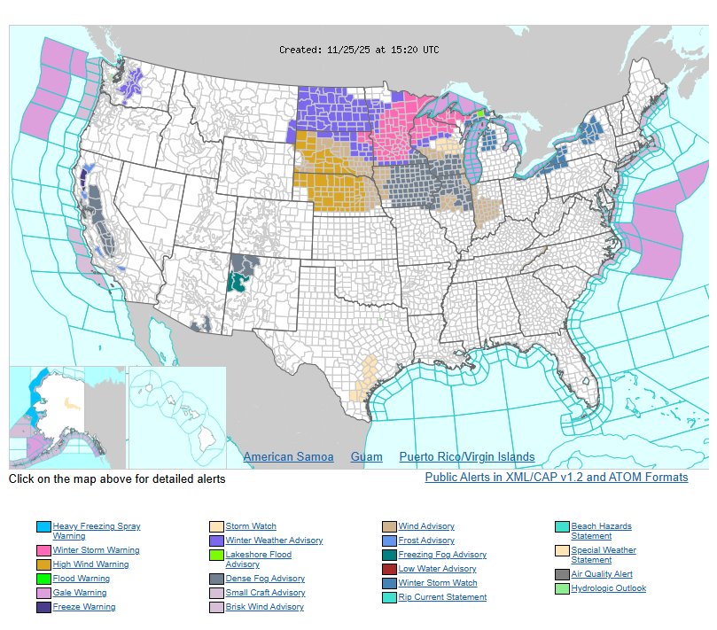
Rain will change to heavy snow across the northern tier states over the next couple of days, with blustery winds making travel difficult.
Flash flooding and severe storms will move through the Deep South this morning and reach the interior Southeast tonight.
Much warmer-than-normal temperatures across the central and eastern U.S. will drop sharply as colder, windy conditions arrive heading into Thanksgiving.
A strong system coming out of western Canada will move west to east across the northern Plains, upper Midwest, and into the Great Lakes. Rain will switch to moderate to heavy snow with strong gusty winds as the system passes. Snow will spread into the upper Great Lakes on Wednesday and continue into Thanksgiving morning. Some areas downwind of Lake Superior may see more than a foot of snow.
Farther south, another system will bring heavy rain and some severe storms across the Deep South and TN Valley today, then move into the central Appalachians, Mid-Atlantic, and New England through tonight. The colder polar air will settle across much of the central and eastern U.S. by Thanksgiving morning.
Out West, conditions stay generally mild. Rain will move into the Pacific Northwest today with snow in the Cascades and northern Rockies. Another system will bring more rain to OR on Wednesday, with additional snow in the Cascades through Thanksgiving morning.
WYOMING
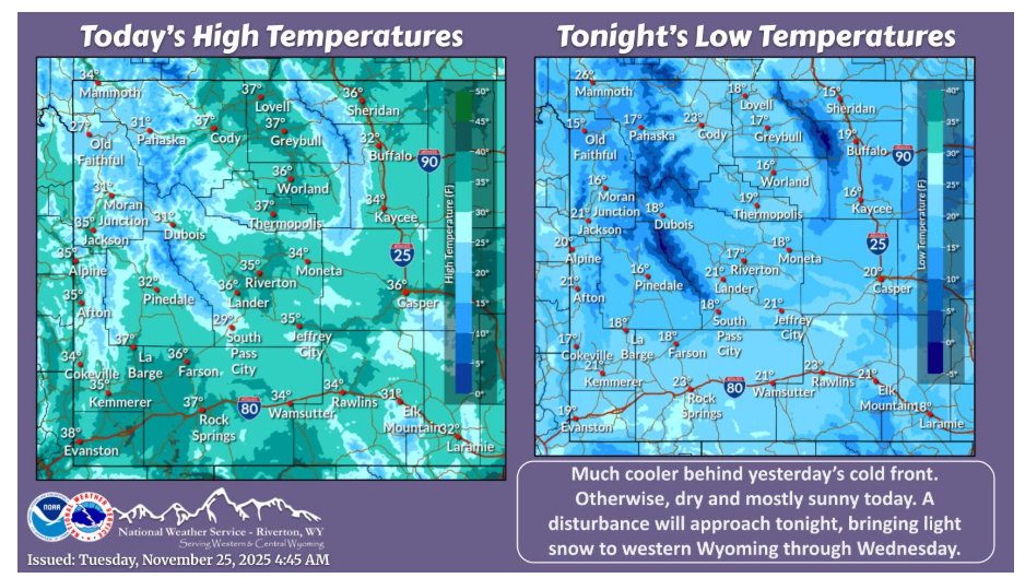
Much cooler behind yesterday’s cold front. Otherwise, dry and mostly sunny today. A disturbance will approach tonight, bringing light snow to western Wyoming through Wednesday.
NEBRASKA
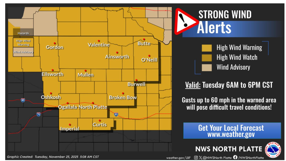
High Wind Warnings are in effect for much of western and central Nebraska Tuesday. Northwest winds with gusts up to 60 mph are expected and could pose the threat of difficult travel, especially for high profile vehicles. Be sure to secure loose outdoor items.
Have a nice day.