
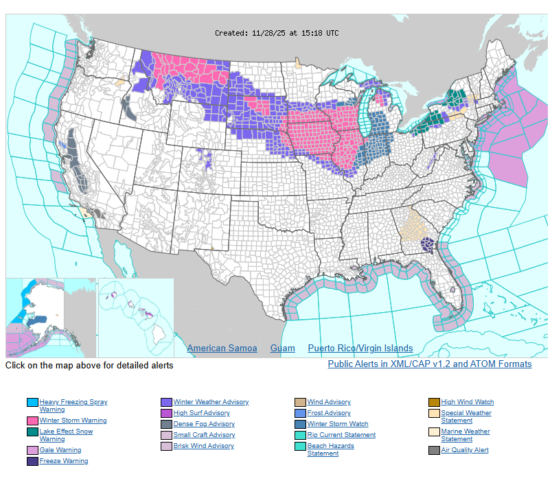
Heavy lake-effect snow will continue across the Great Lakes into early Saturday, with snow squalls expected in the Interior Northeast on Friday. Some areas downwind of Lakes Superior, Erie, and Ontario could see 1–2 feet of snow, causing whiteout conditions and dangerous travel. Conditions improve by Saturday morning.
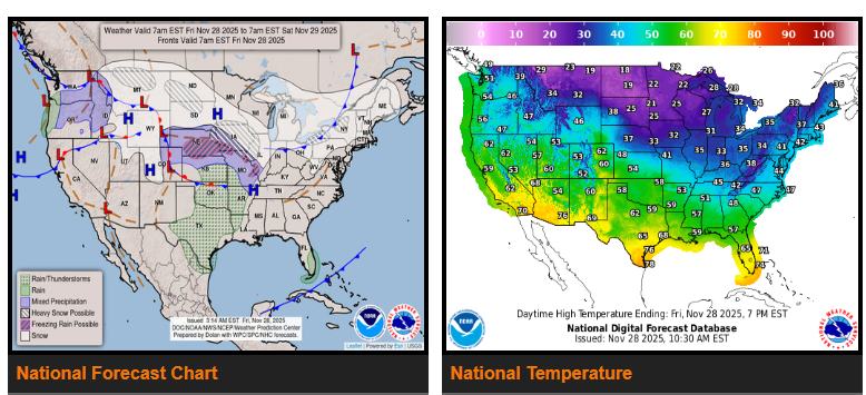
Another major winter storm will impact the Northern Plains and Midwest Friday into Saturday. As the system strengthens, snow will spread from Montana and the Northern Rockies into the Plains and Midwest. Widespread 6–12 inches of snow is likely from eastern South Dakota through the Upper Midwest, with blowing snow and hazardous post-holiday travel. Weather begins to improve late Saturday into Sunday.
Farther south, showers and thunderstorms will move across the Southern Plains into the Mississippi Valley Friday and Saturday. Heavy rain near the western Gulf Coast may cause isolated flash flooding. A wintry mix is expected north of the system across parts of the Missouri Valley, Mid-Mississippi Valley, and Ohio Valley, continuing into the Northeast on Sunday.
Across the eastern and central U.S., a chilly pattern will take hold heading into the weekend. Highs will stay in the 20s and 30s in the Midwest, 30s and 40s in the Northeast and Mid-Atlantic, and 40s–50s in the Southeast. A strong cold front will keep temperatures much colder across the northern and central Plains.
The West will start the weekend mild, with highs in the 40s–60s Friday, before a gradual cooling trend spreads in through Sunday.
WYOMING
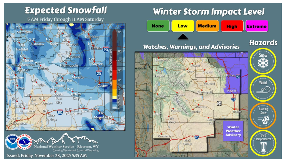
Areas of light snow, mainly east of the Divide, will occur this afternoon through tonight. Gusty winds will occur east of the Divide behind a cold front. Blowing/drifting snow will result across portions of Johnson County tonight into Saturday morning.
NEBRASKA
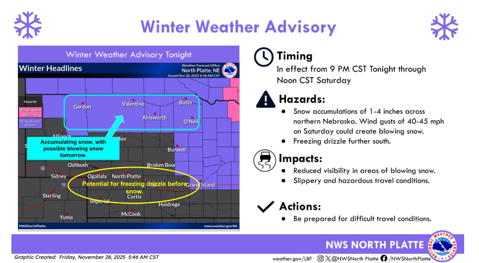
A Winter Weather Advisory has been issued for northern and north central Nebraska this evening through Saturday afternoon. Accumulating snowfall and gusty winds may create areas of blowing snow and difficult travel. Further south, a light glaze of ice is possible before precipitation switches to snow after midnight.
Have a fantastic day.