
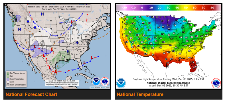
Periods of snow—heavy at times—will impact parts of the Rockies, High Plains, Pacific Northwest, and Great Lakes as an active winter pattern continues. Moderate to heavy rainfall is also expected along the Gulf Coast over the next couple of days, with an isolated flash-flood risk. Meanwhile, a surge of Arctic air may challenge low-temperature records across the Midwest Thursday morning.
A strong winter pattern will persist through the end of the week and into the weekend.
Rockies & High Plains:
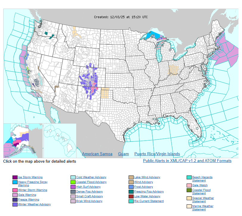
An upper wave dropping south over the central and southern Rockies will continue producing moderate to heavy snow today (Wednesday). Mountain areas can expect 6–12 inches, with higher totals in spots. Lower elevations along the Colorado Front Range may see 3–6 inches. Snow tapers off late tonight into early Thursday. Some wintry weather may extend into the southern High Plains overnight as the system moves east.
Pacific Northwest & Northern Rockies:
Attention shifts west on Thursday as a series of upper-level disturbances bring coastal rain, a wintry mix at lower elevations inland, and heavy snow in the Cascades and northern Rockies. Snow accumulation at lower elevations should remain limited.
Great Lakes & Midwest:
A clipper-type system will move through the Great Lakes today, producing lake-enhanced snowfall. Most areas will see 3–6 inches, with higher amounts in Michigan’s Upper Peninsula. Light snow showers may accompany the trailing cold front across the Midwest, Middle Mississippi Valley, and interior Northeast. Another clipper follows on Thursday, bringing additional snow and some moderate accumulations.
Gulf Coast & Southeast:
Southerly flow will lift a stalled front northward along the western/central Gulf Coast, increasing showers and thunderstorms tonight. Heavy downpours may lead to isolated flash flooding. Precipitation spreads across the Southeast Thursday, while the heaviest rainfall remains near the Gulf Coast frontal boundary. Some wintry precipitation is possible in the Upper Ohio Valley, southern Appalachians, and Mid-Atlantic early Friday, though confidence is lower.
Temperatures:
Chilly conditions hold across much of the central and eastern U.S. Highs will range from the 30s and 40s in the Ohio Valley/Northeast to the 40s and 50s in the Southeast. Another cold front brings frigid temperatures to the Plains and Midwest, with highs only in the single digits and teens in the northern Plains Wednesday, spreading east into Thursday. Morning lows in the Midwest may fall into the negative teens, potentially challenging daily records.
The Interior West stays slightly below average with highs in the 30s and 40s. The Desert Southwest will be in the 60s. The West Coast remains mild and slightly above average, with highs in the 50s and 60s.
WYOMING
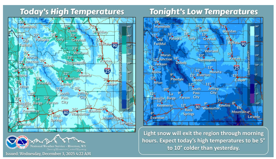
The weather system that brought snow to the area will be exiting the region this morning, leaving colder temperatures in its wake. Breezy winds will also be common across southern Wyoming.
Have a fantastic day.