
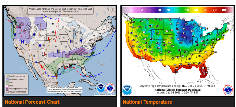
An active winter pattern continues over the next couple of days.
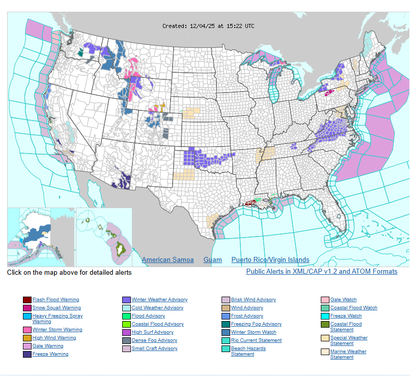
Snow will impact the Great Lakes, interior Northeast, Pacific Northwest, and the Rockies. Snow squalls are possible in the interior Northeast today, creating sudden white-out conditions.
In the West, heavy mountain snowfall is expected in the Cascades and Rockies, with some higher peaks receiving up to several feet. Lower valleys may see lighter snow or a wintry mix.
Along the Gulf Coast, moderate to heavy rainfall is expected, with isolated flash-flooding possible. As colder air moves in, wintry mix and light snow may form from the southern Plains into the Ohio Valley, Appalachians, and parts of the Mid-Atlantic on Thursday night into Friday.
A surge of arctic air will bring very cold temperatures to the Midwest today and into the northern Mid-Atlantic on Friday, with some areas possibly breaking record lows.
WYOMING
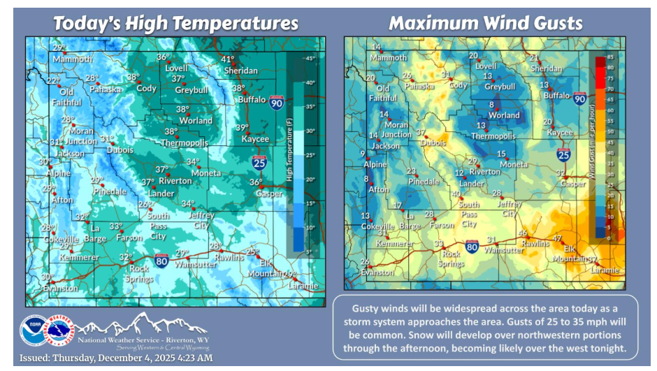
Gusty winds will increase through the morning, with gusts of 25 to 35 mph being widespread. Stronger gusts up to 45 mph expected near Cody. Snow will develop over northwestern portions this afternoon, becoming likely across the west this evening. Snow will continue through Saturday.
Have a fantastic day.