
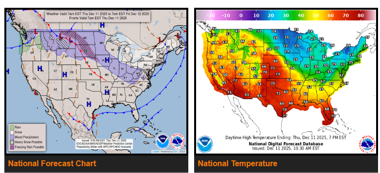
An ongoing atmospheric river over the Pacific Northwest will begin to ease today. Arctic air will push into the Northern Plains late today and Friday, reaching the Upper Midwest this weekend. Lake-effect snow will stay active downwind of Lakes Erie and Ontario. A fast-moving storm will bring moderate to heavy snow from the Mid-Mississippi Valley into the Central Appalachians and the Mid-Atlantic this weekend. Much above-normal temperatures continue across the West, Rockies, Southern Plains, and Lower Mississippi Valley.
The atmospheric river that delivered 5–10+ inches of rain to the Pacific Northwest will finally weaken today as a ridge builds along the West Coast. Even though the heaviest rain is ending, lingering showers through Friday will worsen ongoing river flooding, and landslides remain likely across western WA and northwest OR for several days.
As this ridge strengthens, it will also push Arctic air south into the Northern Plains late today. Temperatures that are well above normal this morning will drop 30–40°F as the front sweeps through. By Friday, highs will be in the single digits across ND and central MT. As this cold air spreads into the Upper Midwest and Ohio Valley, daytime highs may not escape the teens by Saturday.
Across the Great Lakes, the arrival of frigid air over warmer lake water will fuel active lake-effect snow downwind of Lakes Erie and Ontario, where 6–10 inches of snow and 40-mph wind gusts are possible through Friday morning.
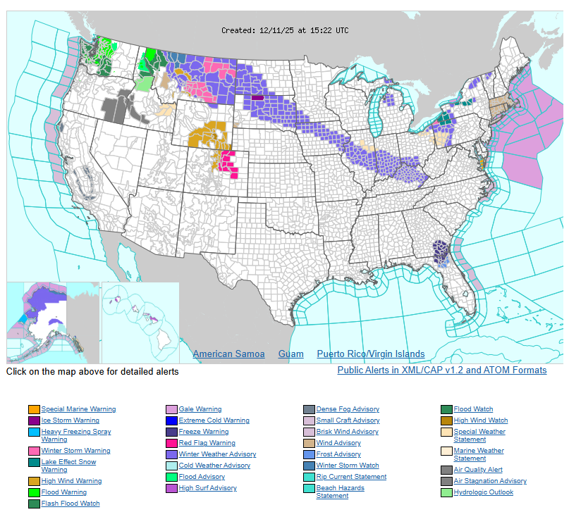
A fast-moving low-pressure system will also bring accumulating snow today into early Friday from the Central Plains to the Ohio Valley. A narrow band of 2–4 inches of snow is expected from the Mid-Mississippi Valley to the Central Appalachians. Just west of the snow zone, up to one-tenth inch of freezing rain is possible over parts of eastern MT and the central Dakotas. Current alerts include Winter Weather Advisories across the Northern High Plains and the Ohio Valley. By Friday night into Saturday, this system will reach the Mid-Atlantic, with 1–2 inches of snow possible along the I-95 corridor from Philadelphia to Washington, D.C.
While much of the north-central and eastern U.S. turns cold, the opposite pattern dominates the West. From the West Coast through the Great Basin, Southwest, and Rockies, temperatures will run 10–20°F above normal today and Friday. The Central Valley of CA will remain cooler due to persistent fog and low clouds, but surrounding areas may see record-high daytime and overnight temperatures through the weekend. Warmth will also expand across the Central and Southern Plains and into the Lower Mississippi Valley and Gulf Coast on Friday.
WYOMING
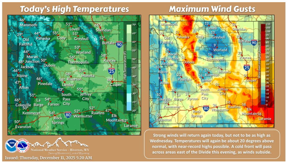
Strong winds will continue across most areas today, but aren’t expected to be as high as Wed. Highs today will continue to be about 20 degrees above normal. A cold front will drop south across areas east of the Divide this evening, as winds subside. Snow will be confined to far northern portions late this afternoon into the evening behind the front.
Have a fantastic day.