
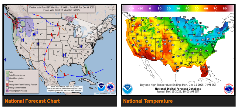
Heavy rain and strong winds continue in the Northwest, while lake-effect snow tapers off and temperatures remain sharply divided across the U.S.
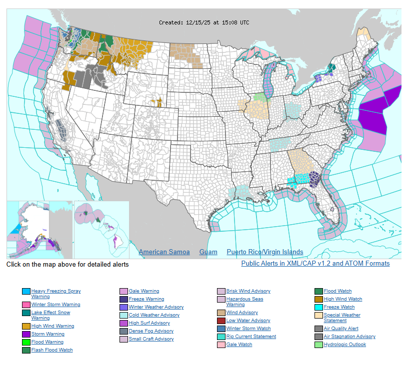
An upper-level low near southeast Alaska will keep moisture flowing into the Northwest over the next few days. A surface low will bring heavy rain to parts of western WA and northwestern OR today, with a slight risk of flash flooding due to saturated soils and unusually high moisture levels. Strong winds are also expected, with High Wind Warnings and Wind Advisories in effect. Conditions should improve Tuesday as the system moves east, but another low will arrive Tuesday night, bringing heavy mountain snow to the northern Cascades.
Lake-effect snow will wind down across the Upper Great Lakes this afternoon and the Lower Great Lakes this evening. Below-average temperatures will persist across much of the East through tonight as Arctic air remains in place, then begin to moderate on Tuesday. Freeze Warnings are in effect from southeast TX through southern GA and northern FL.
Meanwhile, warmer air continues to expand from the West into the Central U.S. Several record or near-record highs are possible across the West as unusually warm conditions persist.
WYOMING
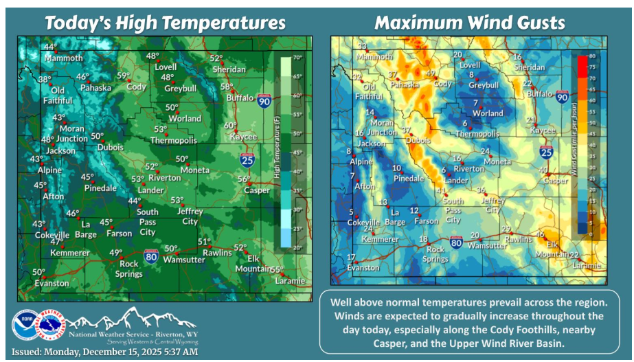
A new week but not much change regarding the weather. Well above normal, near record-breaking temperatures and gusty winds prevail across the Cowboy State today. Winds will increase through the evening, becoming more widespread for Tuesday, and especially Wednesday.
Have a fantastic day.