
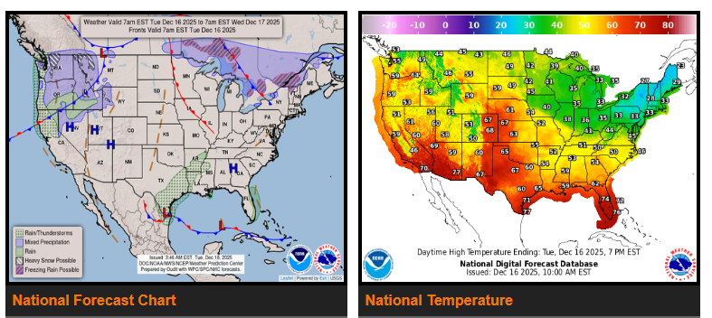
Heavy rain and snow expected in the Northwest this week. Above-average temperatures continue across the West and Central U.S., while Arctic air begins to weaken in the East by Wednesday.
A series of low-pressure systems will impact the Northwest over the next several days, bringing heavy rain, mountain snow, and strong winds. The first system arrives tonight in the Pacific Northwest and will produce heavy rainfall from the northern California coast through western Washington on Wednesday.
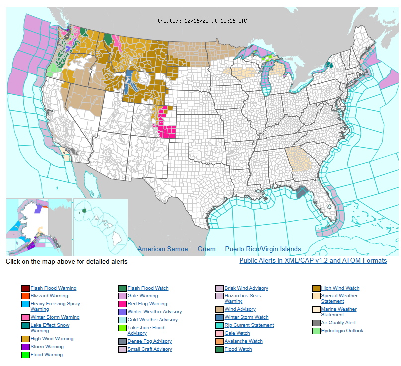
Heavy snow will develop in the northern Cascades this evening and expand into the southern Cascades Wednesday morning after a strong cold front moves through. Several feet of snow are expected in the Cascades and Olympic Mountains by Thursday morning. Rain and mountain snow will also spread into the Northern Rockies, where 1–2 feet of snow is likely, with locally higher amounts possible. Wind, winter, and flood watches and warnings remain in effect across much of the Northwest.
Meanwhile, upper-level ridging over the West and Central U.S. will keep temperatures above average this week. Widespread record highs may be tied or broken in parts of the West. In the East, the recent Arctic air mass will begin to moderate as temperatures rise starting Wednesday.
Farther south, a weak low-pressure system will bring showers and thunderstorms to portions of the south Texas coast beginning tonight and continuing through Wednesday afternoon.
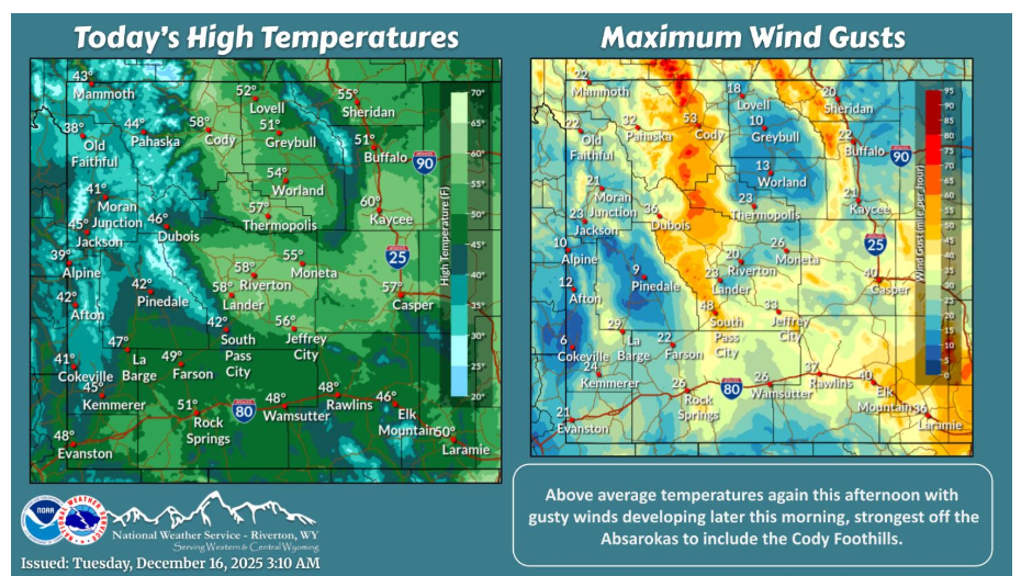
Mainly dry today with a few scattered showers possible near the Idaho border later this morning. Otherwise, warmer than average once again with windy conditions expected this afternoon.
Have nice day.