
Hazardous Weather from the Northwest to the Northern Plains
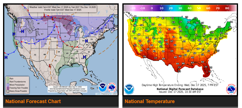
Dangerous wind gusts and heavy snow will create hazardous travel and infrastructure impacts across the Northwest through the Northern Plains over the next few days. Heavy rain is also expected across parts of the Pacific Northwest beginning Thursday. While much of the country remains above average in temperatures today, a sharp cooling trend will move into the Northern Plains and Upper Midwest on Thursday.
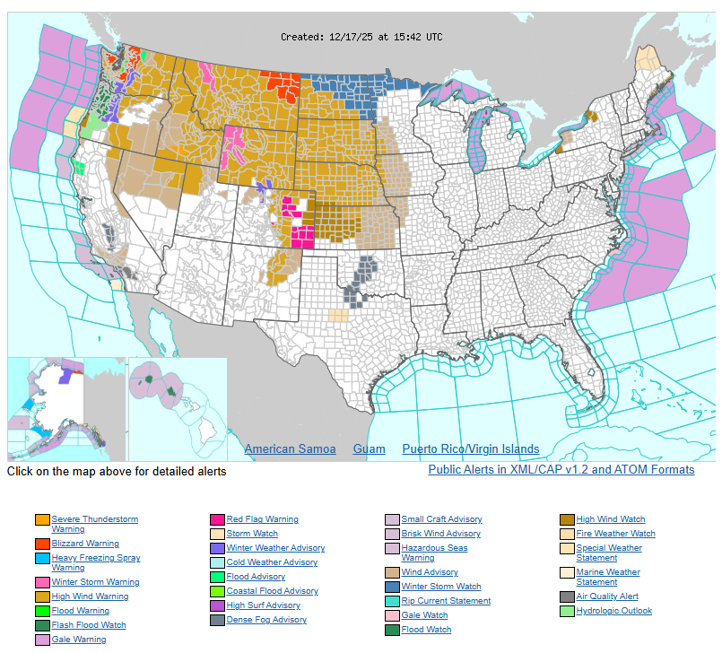
A series of weather disturbances will bring widespread damaging winds, with gusts of 50–70 mph across the Northwest, Northern and Central Rockies, and the Northern Plains through Thursday. Higher elevations in the Rockies could see wind gusts exceeding 80 mph. These strong winds may cause power outages, tree and roof damage, and dangerous driving conditions.
Across the Northern Plains, strong winds combined with snowfall may lead to whiteout conditions tonight into Thursday. Snow squalls moving through the Northern High Plains could rapidly reduce visibility, making travel extremely hazardous.
Heavy snow will continue in the higher elevations of the Cascades and Northern Rockies today, with snow levels dropping to around 3,000 feet by Thursday morning as another round of snow arrives. Heavy, wet snow combined with strong winds could lead to additional power outages and tree damage through Friday.
At lower elevations in the Pacific Northwest, periods of heavy rain will intensify through Friday, increasing the risk of river, creek, and stream flooding. Flood warnings remain in effect, and there is a risk of flash flooding from southwestern Washington through western Oregon and into northwestern California on Thursday, shifting south into southwestern Oregon and northwestern California on Friday.
Looking ahead, a strong ridge over the eastern Pacific will keep temperatures above average across much of the West. Meanwhile, the system responsible for today’s severe weather will strengthen over the Central U.S. on Thursday, bringing a sharp 24-hour temperature drop to the Northern Plains. Farther east, strong southerly winds may lead to unusually warm overnight temperatures and potential record high minimums in parts of the Northeast and Mid-Atlantic.
WYOMING
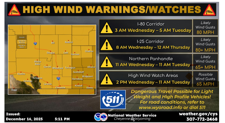
Dec. 16th, 5:15PM – High Wind Watches have been expanded, with most upgraded to High Wind Warnings for Wednesday morning through Thursday morning. Wind gusts over 80mph are expected, with wind prone locations in Platte County potentially seeing wind gusts over 90mph. Use caution if traveling during this period!
NEBRASKA
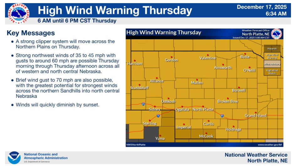
A High Wind Warning is in effect from 6am to 6pm CST Thursday for all of western and north central Nebraska. Northwest winds of 35 to 45 mph with gust of 60 mph or more. Impacts: Travel will be difficult, especially for high profile vehicles. Secure loose objects and inflatables.
Have a fantastic day.