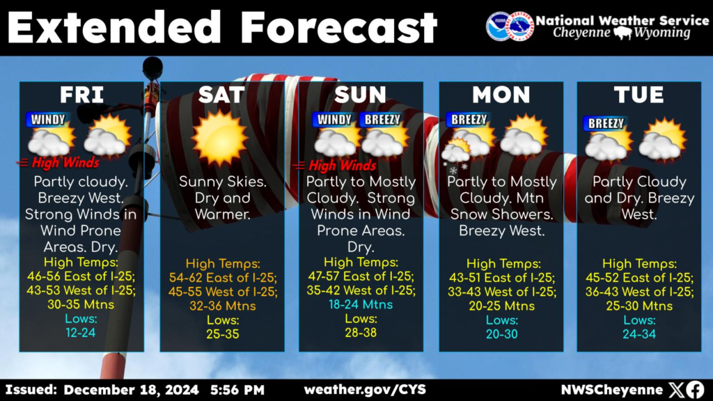
Greetings! A look at the forecast across southeast Wyoming and Nebraska Panhandle calls for mainly dry conditions and bouts of strong winds. Strong winds looking possible for Friday and Sunday, at least for the wind prone areas. Warmer temperatures Friday, with highs in the 50s east of the Laramie Range. Warmest day will be Saturday when we could see low 60s east of the Laramie Range. Keep an eye on the forecast if planning travel Friday and Sunday, as strong winds could impact your travel plans.

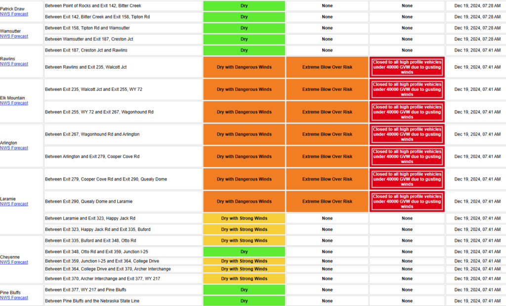
Current conditions/advisories/restrictions on I-80 in Wyoming. They have it set to 40,000 lbs GVW from Rawlins to Laramie, please make sure you are always weighing your equipment, so you know your weights. We have had two drivers in the last month receive violations/citations from not scaling their load.

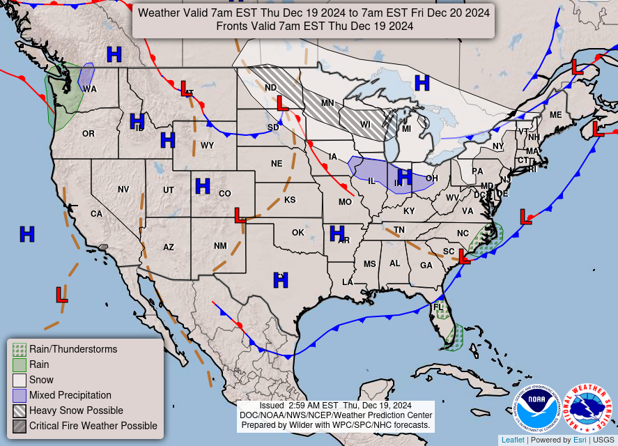
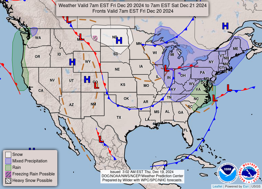
Here is a look the forecast for today and tomorrow. Areas of moderate to heavy snow and gusty to high winds are expected across the Northern Plains, Upper Midwest and Great Lakes into Friday. Several inches of snow accumulation are expected. If you are driving in any of these bad areas, please make sure you slow your speed down and if you need to shut down or have any delays please notify dispatch.


