
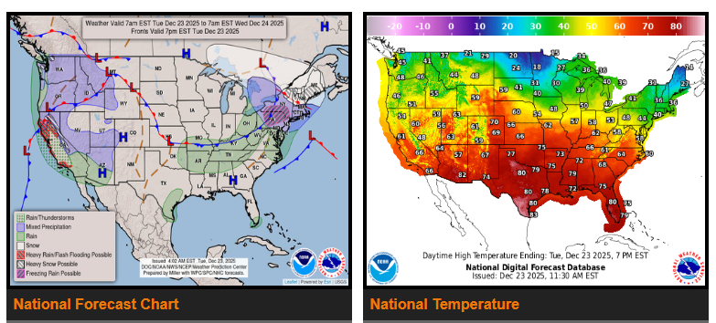
A storm system moving from the Great Lakes to the Central Plains and Northern Rockies will exit the Northeast by Tuesday night. Moisture from the Gulf will bring rain to parts of the Ohio and Tennessee Valleys and the Mid-Atlantic through Tuesday afternoon, then concentrate over the Tennessee Valley Tuesday evening into Wednesday morning.
At the same time, moderate to heavy snow will develop across the Northeast from Tuesday through Wednesday morning. Along the rain/snow line in Pennsylvania and the Central Appalachians, periods of rain and freezing rain are expected Tuesday evening.
By Wednesday evening, a new low-pressure system will form over the Upper/Middle Mississippi Valley and move into the Ohio Valley and Central Appalachians by Thursday morning. This system will bring rain to the Ohio Valley, spreading into the Mid-Atlantic by Christmas morning. Near the northern edge of the system, rain/freezing rain may impact parts of the Great Lakes and Northern Mid-Atlantic from Christmas Eve into Christmas Day. Light snow is expected over Northern New England by Christmas morning.
Meanwhile, Pacific moisture will move into the Pacific Northwest and Northern California, producing rain and higher-elevation snow ahead of a front arriving Wednesday morning. On Tuesday night, rain will also spread into Southern California and the Great Basin.
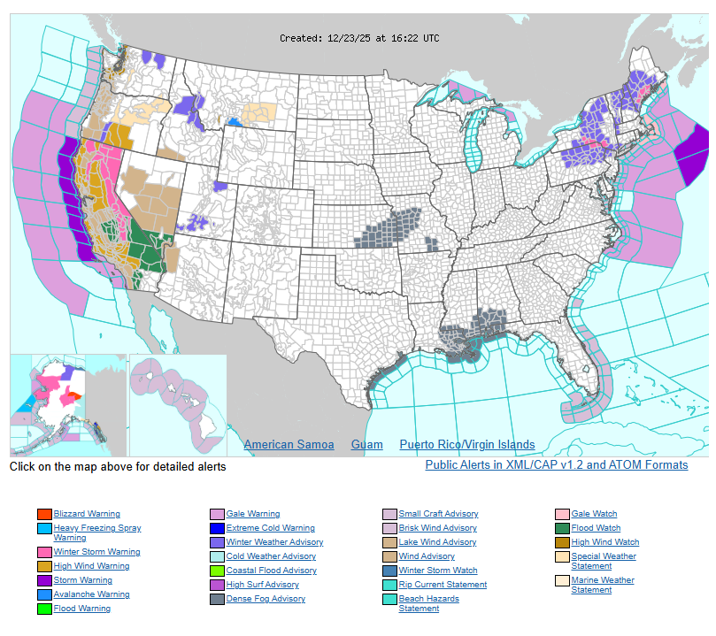
Two areas of heavy rain are expected: Northern/Central California and Southern California. A Slight Risk (Level 2 of 4) for excessive rainfall is in place for these areas through Wednesday morning, with localized flash flooding possible—especially in urban areas, on roads, near small streams, and burn scars.
From Wednesday into Thursday, a strong surge of moisture will bring heavy rain to Southern California. A High Risk (Level 4 of 4) for excessive rainfall has been issued. Severe and widespread flash flooding is expected, including in areas that normally do not flood. Lives and property are at serious risk. A Slight Risk of excessive rainfall will also extend into Northern/Central California and parts of Southern Nevada.
Additionally, heavy snow will impact the Sierra Nevada through Thursday, while rain and high-elevation snow spread across the Great Basin, Southwest, and Central Rockies.
WYOMING
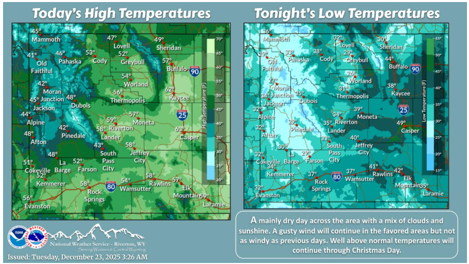
Today will be mainly dry with a mixture of clouds and sunshine. A gusty wind will continue in the favored locations but it will not be as windy as previous days. More record high temperatures are likely this afternoon.
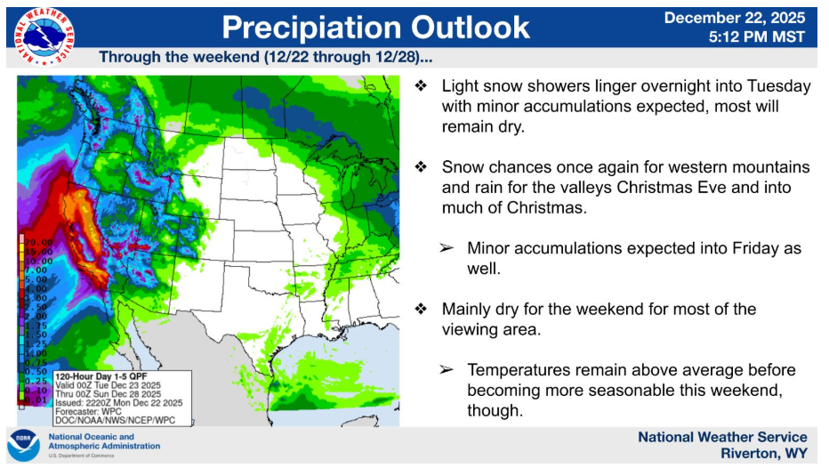
Unsettled weather continues west of the Divide in the short term through Friday, but less accumulations and impacts are expected. The weekend looks to remain dry for most with temperatures finally becoming more seasonable as well.
Have a fantastic day.