
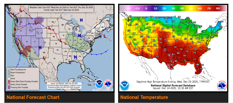
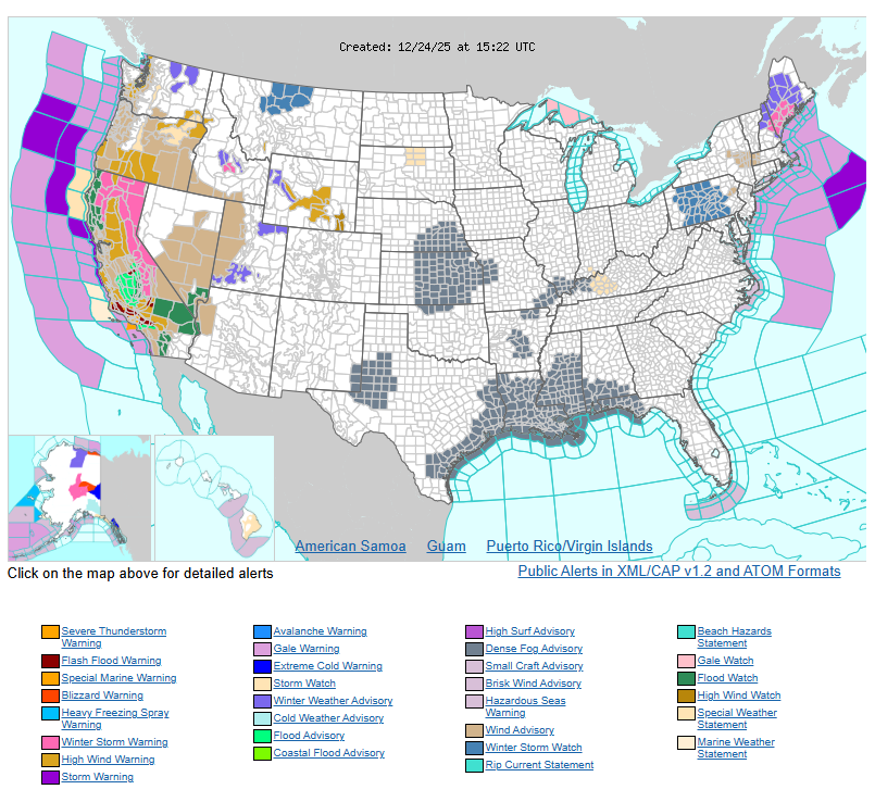
Southern California faces a High Risk of excessive rainfall on Wednesday, with very heavy rain expected through Thursday morning. Severe and widespread flash flooding is likely, including in areas that typically do not flood. Lives and property are at risk. Heavy rain will continue on Christmas, with a Moderate Risk of excessive rainfall from Thursday into Friday, raising concerns for flooding, rising streams, larger rivers, and possible debris flows near burn scars.
Moderate to heavy snow is expected across the Sierra Nevada Mountains, continuing through Friday. Rain and high-elevation snow will also impact the Great Basin and Southwest.
Across the Pacific Northwest and Northern California, a Pacific system will bring rain and mountain snow as a front moves inland.
In the Northeast, moderate to heavy snow will develop through Wednesday afternoon and continue into Christmas. As a low-pressure system exits New England, areas along the northern edge of the storm may see rain or freezing rain, particularly across parts of the Great Lakes and Northern Mid-Atlantic from Christmas Eve into Christmas Day.
Meanwhile, moisture streaming north from the Gulf will produce rain across the Ohio and Tennessee Valleys through Wednesday, expanding into the Mid-Atlantic by Christmas morning.
Overall, expect widespread travel disruptions, dangerous flooding in California, and hazardous winter weather across northern regions.
WYOMING
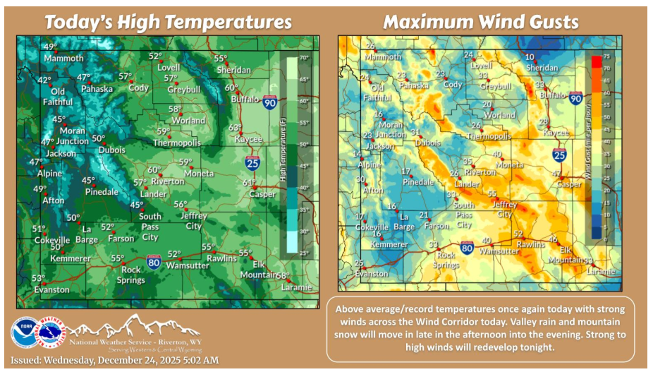
Another day of above normal, record temperatures along with gusty winds across the Wind Corridor (Rock Springs to Johnson County). Rain showers will develop over western portions late in the afternoon, with snow levels of 8000-9000ft. Strong to high winds will return over the Wind Corridor late tonight.
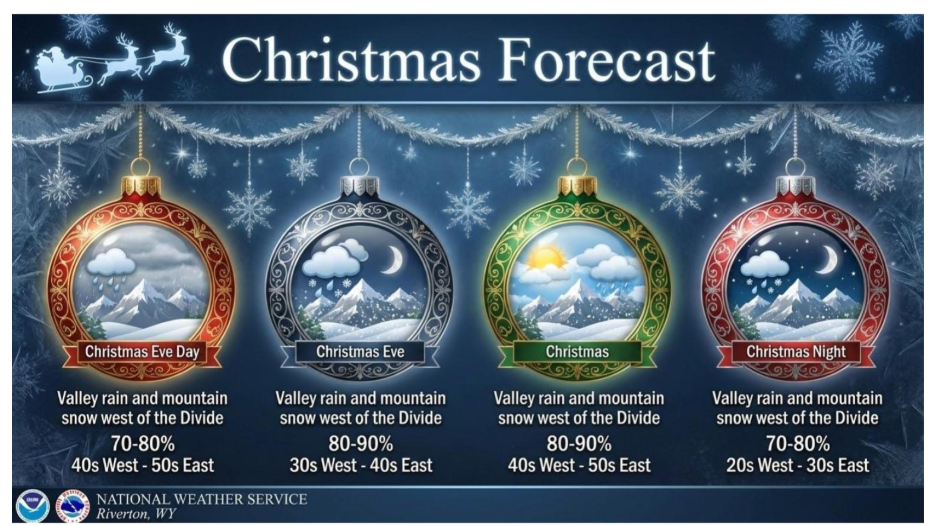
Above average temperatures the next couple days for Christmas! Good chances for valley rain and mountain snow as well, but nothing more than some minor impacts with limited mountain pass snow accumulations for Teton and Togwotee.
Have a fantastic day.