
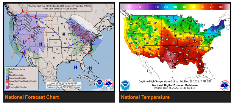
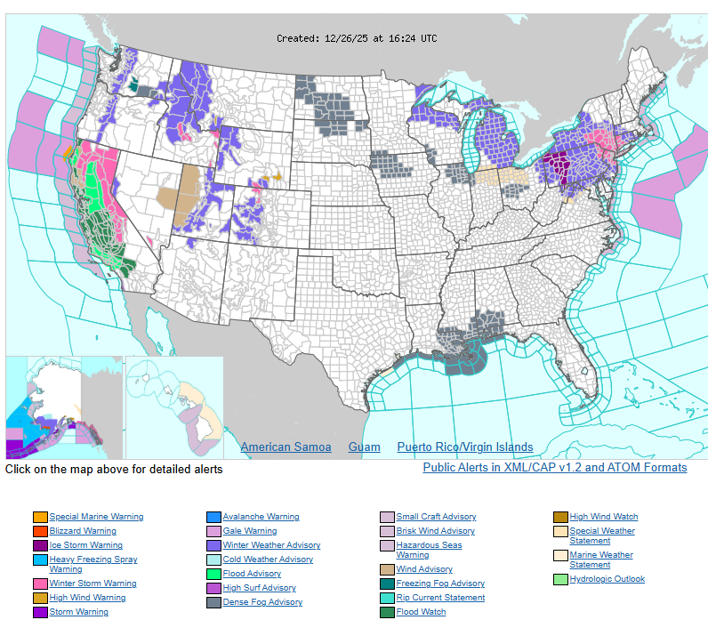
California will see one more wet day today before conditions improve heading into the weekend. Bands of moderate to heavy rain will continue across the state, with a slight risk of flash flooding in Southern California, along with strong winds and isolated thunderstorms near the coast. Heavy snow will continue in the Sierra Nevada, tapering off later tonight. Drying conditions are expected by the weekend.
Across the Upper Midwest, Great Lakes, and Pennsylvania, a winter system will bring snow and ice today into tonight. Light to moderate snow is expected in the Upper Great Lakes, while areas from lower Michigan through Pennsylvania may see up to a quarter inch of freezing rain, with higher amounts possible. Southern New England could receive moderate to heavy snow tonight, with 4–8 inches possible from upstate New York into the New York City and Long Island areas. Travel conditions will be hazardous for post-holiday travelers, especially on untreated roads. Winds may remain gusty into Saturday before improving.
Unseasonably warm weather will continue across the Southern Plains to the Tennessee Valley, with highs reaching the upper 70s to low 80s through the weekend. Some areas may approach or break daily temperature records. Warm overnight lows and high humidity will increase the risk for fog along the Gulf Coast, potentially reducing visibility.
In the Intermountain West, a passing system this weekend will bring gusty winds and snow in higher elevations, with rain showers in lower valleys. By Sunday, a surge of Arctic air will push south into the northern and central Plains. Temperatures near the Canadian border could drop below zero, with dangerous wind chills spreading south into the central Plains.
WYOMING
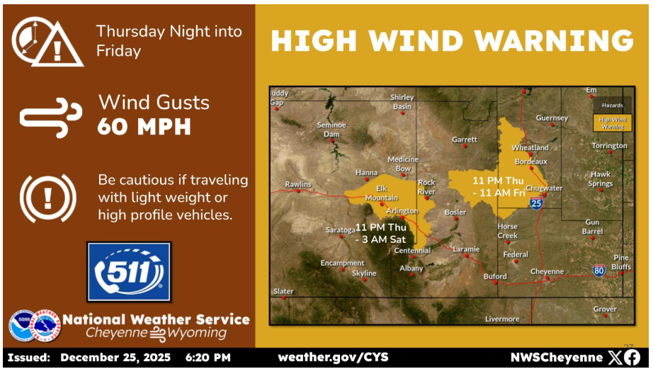
Marginally high winds return to the wind prone areas late tonight into Friday morning, and possibly lasting into early Saturday morning for Arlington/Elk Mountain. Wind gusts are not expected to be steady for this entire period, but travellers should be prepared for occasional wind gusts to around 60 mph along I-80 and I-25 during this time period.
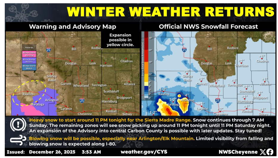
The Winter Storm Watch has been upgraded to a Winter Storm Warning for the Sierra Madre Range. 12 to 18 inches of snow is expected, with potentially 20+ inches in the highest peaks. Winter Weather Advisories have been issued adjacent to the Warning with snow totals in the Snowy Range expected to be between 6 and 10 inches. Other areas in the Advisory may see 2 to 5 inches of snow. Blowing snow may also reduce visibility along I-80 near Arlington and Elk Mountain. Outdoor recreation in the mountains could become dangerous to those caught unprepared for winter conditions.
After nearly a week of record December warmth, wintry weather is expected to return Friday night with the first of two cold fronts. Snowfall will remain mainly confined to Carbon and Albany counties Friday night, but a second, much stronger, cold front arriving Saturday night will spread snow chances eastward into the High Plains. A Winter Storm Watch has been issued for the Sierra Madre Mountains from midnight Friday night through 11AM Sunday where snow totals may exceed 10″. Outside of the mountains, snow accumulation is expected to be more modest, but travel impacts are possible Friday night in Carbon/Albany counties and Saturday night into Sunday morning across a wider area.
Please stay alert, monitor local weather alerts, and travel safely.