
Happy Friday! Here’s a look at the weekend weather forecast:
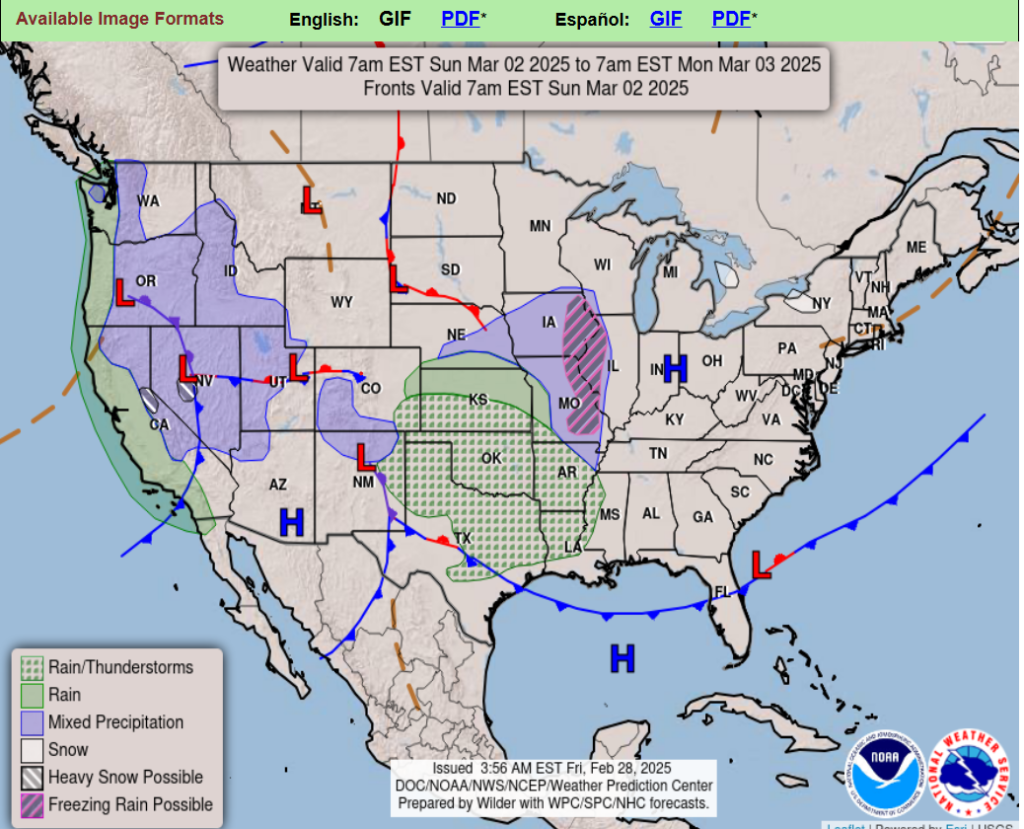
Temperatures will be 10 to 20 degrees below average behind a strong cold front across the Midwest and Ohio Valley on Saturday. An Elevated Risk of fire weather conditions over parts of the Plains on Friday.
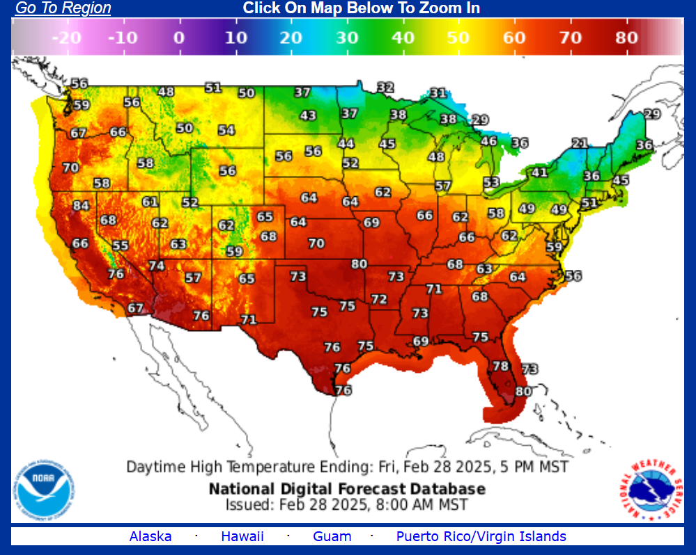
The last day of the work week will be featured with a brief return to above average temperatures across the Midwest states with highs running well into the 40s and 50s, and 60s across the central Plains.
Along with that comes an increased fire weather potential with dry grounds and gusty winds expected based on the latest outlook from the Storm Prediction Center. A strong late winter cold front will bring a return to reality going into Saturday from the Upper Midwest to the Great Lakes and Ohio Valley, with pleasantly mild conditions from the Deep South to the coastal Mid-Atlantic.
Out West, showers are likely to make a return to the northern half of California and coastal portions of the Pacific Northwest on Saturday as the next storm system move into the region. There may also be some rain and mountain snow for portions of the southern Rockies in conjunction with an upper low moving over that region. Elsewhere, mostly dry conditions can be expected through Sunday morning as high pressure governs the overall weather pattern
Wyoming;
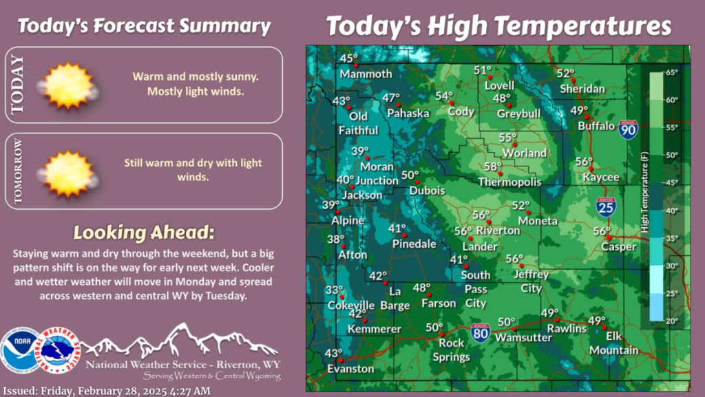
It remains warm and dry through the weekend. Temperatures across portions of central WY will reach the low 60s this weekend! But a pattern change is on the way to start the work week. Colder and wetter weather will spread across the region Monday into Tuesday.
Stay safe out there and enjoy the warm weather this weekend!
Have a great weekend!