
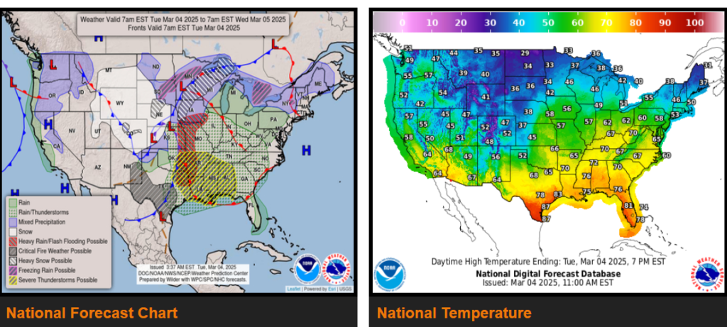
A major winter storm ejecting out into the Central U.S. will bring widespread hazards going through midweek including damaging high winds, blizzard conditions, severe weather, and a concern for some flash flooding.
There is critical to extreme fire weather danger across much of the Southern High Plains going through the early to middle part of the week.
Much above normal temperatures across the Midwest will move into the Eastern U.S. by midweek, with below normal temperatures over the West gradually reaching the Plains.
Widespread hazardous weather is expected across the central U.S. as potent low pressure system treks through the Central Plains today, Midwest by tonight and across the Great Lakes region Wednesday. Some of the higher elevations of the Central Rockies could see snow accumulations of 1 to 2 feet with this system. Additionally, a swath of 4 to 8 inches along with very strong winds will setup from the Central High Plains to the Upper Midwest resulting in a vast area with blizzard conditions. Local max snow totals may approach 1 foot.
Wyoming
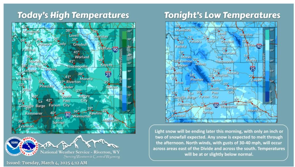
Snow will end across the area later this morning. Temperatures will be at or slightly below normal in the wake of yesterday’s cold front. Gusty north winds will continue across the Bighorn Basin, Johnson/Natrona counties and across the south.
Remember, safety comes first—drive safe out there! Wishing you a great day!