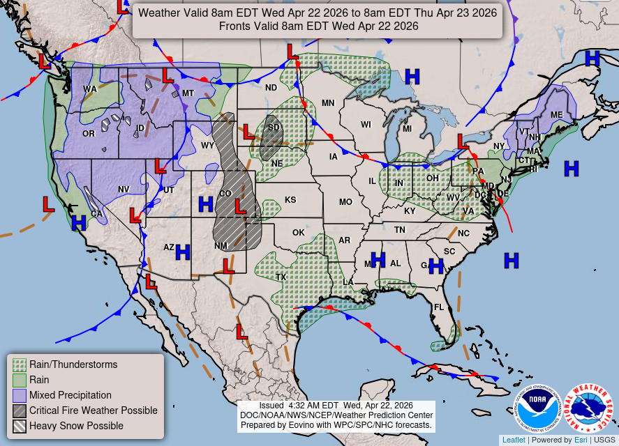
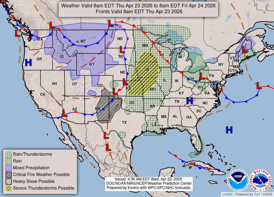
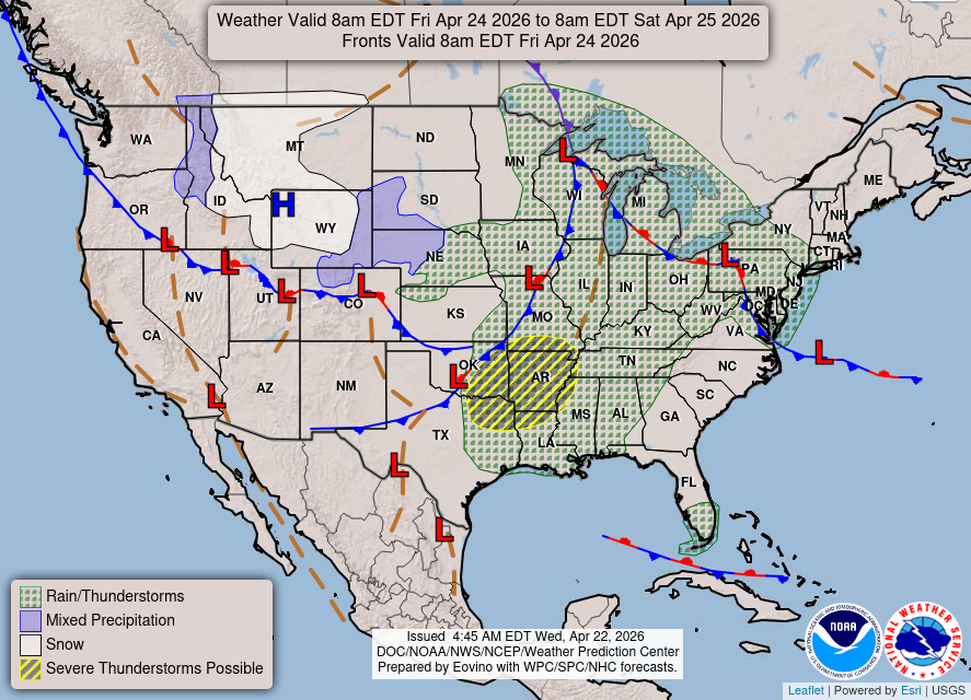
A Pacific storm system will continue to bring low elevation rain and mountain snow to much of the West through today, with heavy mountain snow expected in the higher elevations of the Sierra Nevada. This system will also bring strong winds to the Intermountain West, Rockies, and Plains, which will create Critical fire weather conditions for the High Plains.
National Weather Service Alerts:
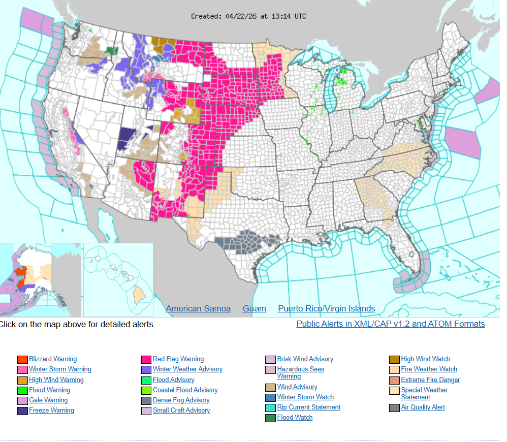
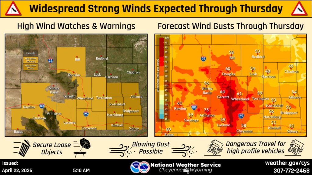
High Wind Watches across southeast Wyoming have been upgraded to High Wind Warnings, with gusts between 60 and 70 mph possible. The typical wind prone areas could see gusts upwards of 80 mph, especially near the I-80 Summit and Bordeaux. Use caution if traveling with lightweight or high profile vehicles.
Three day forecast maps: